You are here: Home > Network List > TA - USArray Transportable Network (new EarthScope stations) Stations List
> Station I30M Mount Dempster, Yukon, CAN > Earthquake Result Viewer
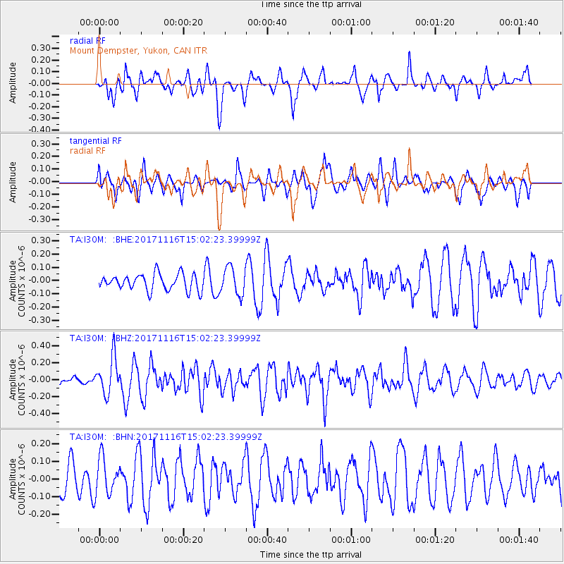
I30M Mount Dempster, Yukon, CAN - Earthquake Result Viewer
*The percent match for this event was below the threshold and hence no stack was calculated.
| Earthquake location: |
Solomon Islands |
| Earthquake latitude/longitude: |
-10.1/160.9 |
| Earthquake time(UTC): |
2017/11/16 (320) 14:50:04 GMT |
| Earthquake Depth: |
10 km |
| Earthquake Magnitude: |
5.6 mb |
| Earthquake Catalog/Contributor: |
NEIC PDE/us |
|
| Network: |
TA USArray Transportable Network (new EarthScope stations) |
| Station: |
I30M Mount Dempster, Yukon, CAN |
| Lat/Lon: |
65.22 N/136.38 W |
| Elevation: |
1399 m |
|
| Distance: |
88.1 deg |
| Az: |
22.003 deg |
| Baz: |
241.101 deg |
| Ray Param: |
$rayparam |
*The percent match for this event was below the threshold and hence was not used in the summary stack. |
|
| Radial Match: |
63.88652 % |
| Radial Bump: |
400 |
| Transverse Match: |
48.934826 % |
| Transverse Bump: |
400 |
| SOD ConfigId: |
13570011 |
| Insert Time: |
2019-04-29 06:11:40.156 +0000 |
| GWidth: |
2.5 |
| Max Bumps: |
400 |
| Tol: |
0.001 |
|
Signal To Noise
| Channel | StoN | STA | LTA |
| TA:I30M: :BHZ:20171116T15:02:23.39999Z | 2.854646 | 2.1982407E-7 | 7.7005716E-8 |
| TA:I30M: :BHN:20171116T15:02:23.39999Z | 0.7952782 | 1.0177415E-7 | 1.2797302E-7 |
| TA:I30M: :BHE:20171116T15:02:23.39999Z | 1.719569 | 1.052698E-7 | 6.1218714E-8 |
| Arrivals |
| Ps | |
| PpPs | |
| PsPs/PpSs | |


