You are here: Home > Network List > UW - Pacific Northwest Regional Seismic Network Stations List
> Station LTY Liberty (broad-band) > Earthquake Result Viewer
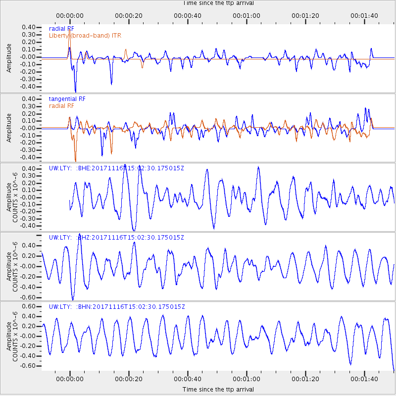
LTY Liberty (broad-band) - Earthquake Result Viewer
*The percent match for this event was below the threshold and hence no stack was calculated.
| Earthquake location: |
Solomon Islands |
| Earthquake latitude/longitude: |
-10.1/160.9 |
| Earthquake time(UTC): |
2017/11/16 (320) 14:50:04 GMT |
| Earthquake Depth: |
10 km |
| Earthquake Magnitude: |
5.6 mb |
| Earthquake Catalog/Contributor: |
NEIC PDE/us |
|
| Network: |
UW Pacific Northwest Regional Seismic Network |
| Station: |
LTY Liberty (broad-band) |
| Lat/Lon: |
47.26 N/120.66 W |
| Elevation: |
970 m |
|
| Distance: |
89.6 deg |
| Az: |
41.858 deg |
| Baz: |
254.728 deg |
| Ray Param: |
$rayparam |
*The percent match for this event was below the threshold and hence was not used in the summary stack. |
|
| Radial Match: |
55.716305 % |
| Radial Bump: |
400 |
| Transverse Match: |
52.38668 % |
| Transverse Bump: |
400 |
| SOD ConfigId: |
13570011 |
| Insert Time: |
2019-04-29 06:12:33.810 +0000 |
| GWidth: |
2.5 |
| Max Bumps: |
400 |
| Tol: |
0.001 |
|
Signal To Noise
| Channel | StoN | STA | LTA |
| UW:LTY: :BHZ:20171116T15:02:30.175015Z | 2.056629 | 3.9170502E-7 | 1.9045974E-7 |
| UW:LTY: :BHN:20171116T15:02:30.175015Z | 0.80038947 | 1.6751164E-7 | 2.0928766E-7 |
| UW:LTY: :BHE:20171116T15:02:30.175015Z | 0.42509767 | 9.290833E-8 | 2.185576E-7 |
| Arrivals |
| Ps | |
| PpPs | |
| PsPs/PpSs | |


