X15A Humboldt, AZ, USA - Earthquake Result Viewer
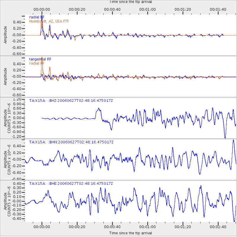
Earthquake location: Rat Islands, Aleutian Islands
Earthquake latitude/longitude: 52.2/176.2
Earthquake time(UTC): 2006/06/27 (178) 02:39:35 GMT
Earthquake Depth: 34 km
Earthquake Magnitude: 5.6 MB, 6.0 MS, 6.2 MW, 6.2 MW
Earthquake Catalog/Contributor: WHDF/NEIC
Network: TA USArray Transportable Network (new EarthScope stations)
Station: X15A Humboldt, AZ, USA
Lat/Lon: 34.49 N/112.24 W
Elevation: 1332 m
Distance: 52.8 deg
Az: 79.791 deg
Baz: 312.842 deg
Ray Param: 0.066476524
Estimated Moho Depth: 25.75 km
Estimated Crust Vp/Vs: 2.07
Assumed Crust Vp: 6.276 km/s
Estimated Crust Vs: 3.032 km/s
Estimated Crust Poisson's Ratio: 0.35
Radial Match: 87.865005 %
Radial Bump: 295
Transverse Match: 59.689987 %
Transverse Bump: 400
SOD ConfigId: 2665
Insert Time: 2010-03-06 06:40:59.471 +0000
GWidth: 2.5
Max Bumps: 400
Tol: 0.001

Signal To Noise

ChannelStoNSTALTA
TA:X15A: :BHN:20060627T02:48:16.475017Z2.33530741.11562954E-74.777228E-8
TA:X15A: :BHE:20060627T02:48:16.475017Z3.31648161.2618587E-73.8048114E-8
TA:X15A: :BHZ:20060627T02:48:16.475017Z12.9980183.841555E-72.9554927E-8
Arrivals
Ps4.6 SECOND
PpPs12 SECOND
PsPs/PpSs17 SECOND