You are here: Home > Network List > TA - USArray Transportable Network (new EarthScope stations) Stations List
> Station X15A Humboldt, AZ, USA > Earthquake Result Viewer
X15A Humboldt, AZ, USA - Earthquake Result Viewer
*The percent match for this event was below the threshold and hence no stack was calculated.
| Earthquake location: |
Colombia |
| Earthquake latitude/longitude: |
4.8/-75.5 |
| Earthquake time(UTC): |
2008/09/13 (257) 09:32:01 GMT |
| Earthquake Depth: |
133 km |
| Earthquake Magnitude: |
5.9 MB, 5.7 MW, 5.7 MW |
| Earthquake Catalog/Contributor: |
WHDF/NEIC |
|
| Network: |
TA USArray Transportable Network (new EarthScope stations) |
| Station: |
X15A Humboldt, AZ, USA |
| Lat/Lon: |
34.49 N/112.24 W |
| Elevation: |
1332 m |
|
| Distance: |
45.0 deg |
| Az: |
315.738 deg |
| Baz: |
122.645 deg |
| Ray Param: |
$rayparam |
*The percent match for this event was below the threshold and hence was not used in the summary stack. |
|
| Radial Match: |
78.58367 % |
| Radial Bump: |
340 |
| Transverse Match: |
57.702427 % |
| Transverse Bump: |
400 |
| SOD ConfigId: |
2504 |
| Insert Time: |
2010-03-06 06:41:47.817 +0000 |
| GWidth: |
2.5 |
| Max Bumps: |
400 |
| Tol: |
0.001 |
|
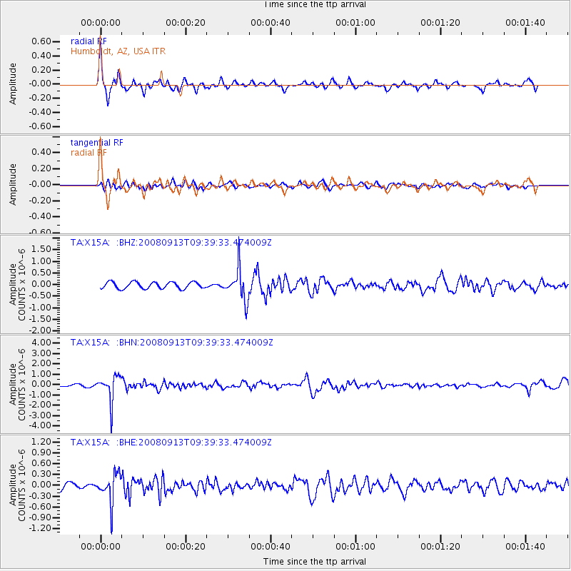
Signal To Noise
| Channel | StoN | STA | LTA |
| TA:X15A: :BHN:20080913T09:39:33.474009Z | 8.130204 | 1.2621612E-6 | 1.5524348E-7 |
| TA:X15A: :BHE:20080913T09:39:33.474009Z | 2.3525167 | 3.9403022E-7 | 1.6749306E-7 |
| TA:X15A: :BHZ:20080913T09:39:33.474009Z | 4.922416 | 6.8383457E-7 | 1.3892253E-7 |
| Arrivals |
| Ps | |
| PpPs | |
| PsPs/PpSs | |


