You are here: Home > Network List > TA - USArray Transportable Network (new EarthScope stations) Stations List
> Station C16K Lisburne Hills, AK, USA > Earthquake Result Viewer
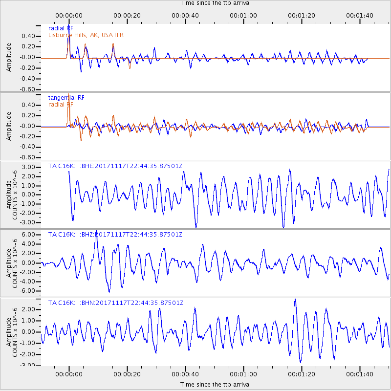
C16K Lisburne Hills, AK, USA - Earthquake Result Viewer
*The percent match for this event was below the threshold and hence no stack was calculated.
| Earthquake location: |
Eastern Xizang-India Border Reg. |
| Earthquake latitude/longitude: |
29.8/95.0 |
| Earthquake time(UTC): |
2017/11/17 (321) 22:34:19 GMT |
| Earthquake Depth: |
8.0 km |
| Earthquake Magnitude: |
6.4 Mww |
| Earthquake Catalog/Contributor: |
NEIC PDE/us |
|
| Network: |
TA USArray Transportable Network (new EarthScope stations) |
| Station: |
C16K Lisburne Hills, AK, USA |
| Lat/Lon: |
68.27 N/165.34 W |
| Elevation: |
102 m |
|
| Distance: |
66.1 deg |
| Az: |
23.668 deg |
| Baz: |
290.442 deg |
| Ray Param: |
$rayparam |
*The percent match for this event was below the threshold and hence was not used in the summary stack. |
|
| Radial Match: |
74.256065 % |
| Radial Bump: |
400 |
| Transverse Match: |
61.873592 % |
| Transverse Bump: |
400 |
| SOD ConfigId: |
13570011 |
| Insert Time: |
2019-04-29 06:24:45.551 +0000 |
| GWidth: |
2.5 |
| Max Bumps: |
400 |
| Tol: |
0.001 |
|
Signal To Noise
| Channel | StoN | STA | LTA |
| TA:C16K: :BHZ:20171117T22:44:35.87501Z | 3.5279622 | 1.6068582E-6 | 4.5546352E-7 |
| TA:C16K: :BHN:20171117T22:44:35.87501Z | 0.78370637 | 6.0426584E-7 | 7.71036E-7 |
| TA:C16K: :BHE:20171117T22:44:35.87501Z | 1.2948335 | 1.2278368E-6 | 9.4825845E-7 |
| Arrivals |
| Ps | |
| PpPs | |
| PsPs/PpSs | |


