You are here: Home > Network List > AK - Alaska Regional Network Stations List
> Station CUT Chulitna, AK, USA > Earthquake Result Viewer
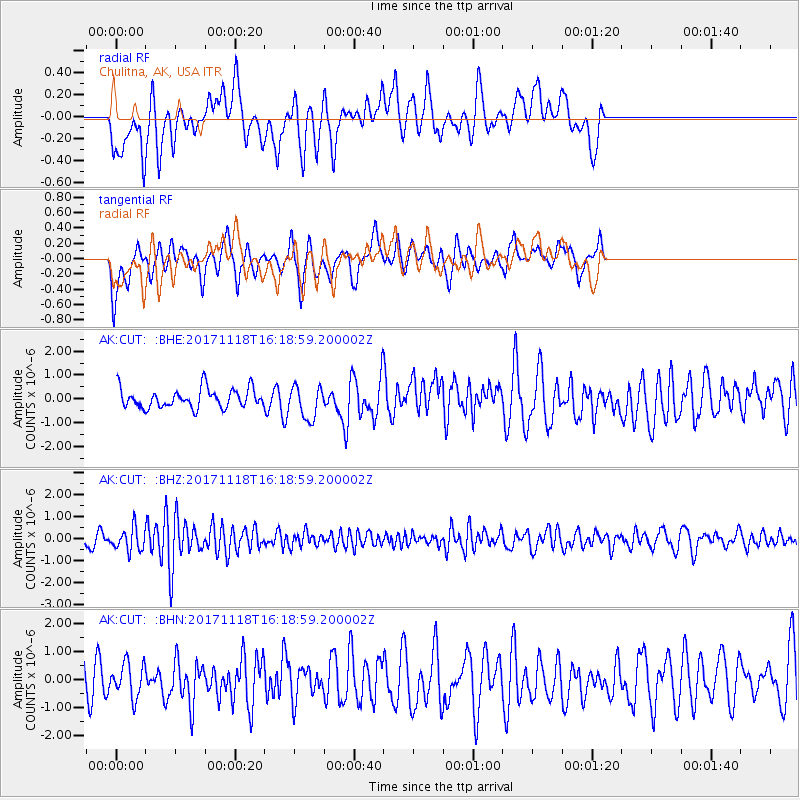
CUT Chulitna, AK, USA - Earthquake Result Viewer
*The percent match for this event was below the threshold and hence no stack was calculated.
| Earthquake location: |
Halmahera, Indonesia |
| Earthquake latitude/longitude: |
2.4/128.1 |
| Earthquake time(UTC): |
2017/11/18 (322) 16:07:02 GMT |
| Earthquake Depth: |
20 km |
| Earthquake Magnitude: |
5.9 Mww |
| Earthquake Catalog/Contributor: |
NEIC PDE/us |
|
| Network: |
AK Alaska Regional Network |
| Station: |
CUT Chulitna, AK, USA |
| Lat/Lon: |
62.41 N/150.26 W |
| Elevation: |
574 m |
|
| Distance: |
84.0 deg |
| Az: |
27.593 deg |
| Baz: |
263.647 deg |
| Ray Param: |
$rayparam |
*The percent match for this event was below the threshold and hence was not used in the summary stack. |
|
| Radial Match: |
48.765583 % |
| Radial Bump: |
400 |
| Transverse Match: |
50.40718 % |
| Transverse Bump: |
377 |
| SOD ConfigId: |
13570011 |
| Insert Time: |
2019-04-29 06:35:12.814 +0000 |
| GWidth: |
2.5 |
| Max Bumps: |
400 |
| Tol: |
0.001 |
|
Signal To Noise
| Channel | StoN | STA | LTA |
| AK:CUT: :BHZ:20171118T16:18:59.200002Z | 2.6148732 | 5.27585E-7 | 2.0176313E-7 |
| AK:CUT: :BHN:20171118T16:18:59.200002Z | 1.0287987 | 6.0852676E-7 | 5.9149255E-7 |
| AK:CUT: :BHE:20171118T16:18:59.200002Z | 1.692844 | 6.714865E-7 | 3.966618E-7 |
| Arrivals |
| Ps | |
| PpPs | |
| PsPs/PpSs | |


