You are here: Home > Network List > TA - USArray Transportable Network (new EarthScope stations) Stations List
> Station F20K Avaraart Lake, AK, USA > Earthquake Result Viewer
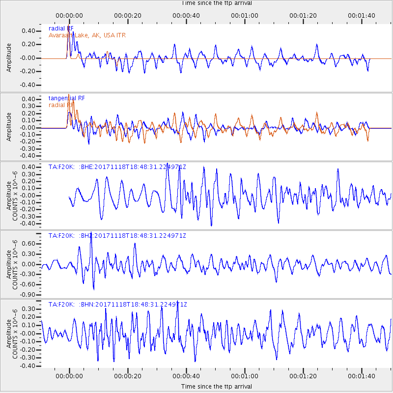
F20K Avaraart Lake, AK, USA - Earthquake Result Viewer
*The percent match for this event was below the threshold and hence no stack was calculated.
| Earthquake location: |
Halmahera, Indonesia |
| Earthquake latitude/longitude: |
2.4/128.1 |
| Earthquake time(UTC): |
2017/11/18 (322) 18:36:41 GMT |
| Earthquake Depth: |
17 km |
| Earthquake Magnitude: |
5.4 Mww |
| Earthquake Catalog/Contributor: |
NEIC PDE/us |
|
| Network: |
TA USArray Transportable Network (new EarthScope stations) |
| Station: |
F20K Avaraart Lake, AK, USA |
| Lat/Lon: |
67.05 N/155.73 W |
| Elevation: |
136 m |
|
| Distance: |
82.4 deg |
| Az: |
22.588 deg |
| Baz: |
258.12 deg |
| Ray Param: |
$rayparam |
*The percent match for this event was below the threshold and hence was not used in the summary stack. |
|
| Radial Match: |
50.789547 % |
| Radial Bump: |
400 |
| Transverse Match: |
56.79938 % |
| Transverse Bump: |
400 |
| SOD ConfigId: |
13570011 |
| Insert Time: |
2019-04-29 06:40:26.038 +0000 |
| GWidth: |
2.5 |
| Max Bumps: |
400 |
| Tol: |
0.001 |
|
Signal To Noise
| Channel | StoN | STA | LTA |
| TA:F20K: :BHZ:20171118T18:48:31.224971Z | 3.2176282 | 2.3735791E-7 | 7.376797E-8 |
| TA:F20K: :BHN:20171118T18:48:31.224971Z | 0.91794455 | 1.0720962E-7 | 1.1679313E-7 |
| TA:F20K: :BHE:20171118T18:48:31.224971Z | 1.5909599 | 1.9898569E-7 | 1.2507273E-7 |
| Arrivals |
| Ps | |
| PpPs | |
| PsPs/PpSs | |


