You are here: Home > Network List > TJ - Tajikistan National Seismic Network Stations List
> Station GARM Garm, Tajikistan > Earthquake Result Viewer
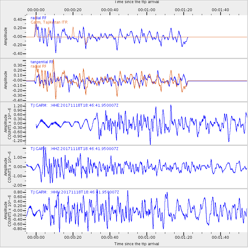
GARM Garm, Tajikistan - Earthquake Result Viewer
*The percent match for this event was below the threshold and hence no stack was calculated.
| Earthquake location: |
Halmahera, Indonesia |
| Earthquake latitude/longitude: |
2.4/128.1 |
| Earthquake time(UTC): |
2017/11/18 (322) 18:36:41 GMT |
| Earthquake Depth: |
17 km |
| Earthquake Magnitude: |
5.4 Mww |
| Earthquake Catalog/Contributor: |
NEIC PDE/us |
|
| Network: |
TJ Tajikistan National Seismic Network |
| Station: |
GARM Garm, Tajikistan |
| Lat/Lon: |
39.00 N/70.32 E |
| Elevation: |
1305 m |
|
| Distance: |
63.9 deg |
| Az: |
312.722 deg |
| Baz: |
109.608 deg |
| Ray Param: |
$rayparam |
*The percent match for this event was below the threshold and hence was not used in the summary stack. |
|
| Radial Match: |
71.10008 % |
| Radial Bump: |
400 |
| Transverse Match: |
68.13802 % |
| Transverse Bump: |
400 |
| SOD ConfigId: |
13570011 |
| Insert Time: |
2019-04-29 06:40:47.785 +0000 |
| GWidth: |
2.5 |
| Max Bumps: |
400 |
| Tol: |
0.001 |
|
Signal To Noise
| Channel | StoN | STA | LTA |
| TJ:GARM: :HHZ:20171118T18:46:41.950007Z | 3.370917 | 7.743703E-7 | 2.2972095E-7 |
| TJ:GARM: :HHN:20171118T18:46:41.950007Z | 0.9512249 | 1.7067235E-7 | 1.7942375E-7 |
| TJ:GARM: :HHE:20171118T18:46:41.950007Z | 3.3997 | 4.822468E-7 | 1.4184981E-7 |
| Arrivals |
| Ps | |
| PpPs | |
| PsPs/PpSs | |


