You are here: Home > Network List > TA - USArray Transportable Network (new EarthScope stations) Stations List
> Station D25K Kavik River, AK, USA > Earthquake Result Viewer
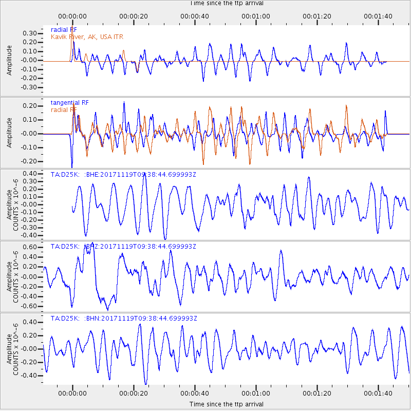
D25K Kavik River, AK, USA - Earthquake Result Viewer
*The percent match for this event was below the threshold and hence no stack was calculated.
| Earthquake location: |
Loyalty Islands |
| Earthquake latitude/longitude: |
-21.7/168.7 |
| Earthquake time(UTC): |
2017/11/19 (323) 09:25:47 GMT |
| Earthquake Depth: |
4.0 km |
| Earthquake Magnitude: |
6.3 mww |
| Earthquake Catalog/Contributor: |
NEIC PDE/us |
|
| Network: |
TA USArray Transportable Network (new EarthScope stations) |
| Station: |
D25K Kavik River, AK, USA |
| Lat/Lon: |
69.32 N/146.38 W |
| Elevation: |
770 m |
|
| Distance: |
96.3 deg |
| Az: |
14.616 deg |
| Baz: |
221.367 deg |
| Ray Param: |
$rayparam |
*The percent match for this event was below the threshold and hence was not used in the summary stack. |
|
| Radial Match: |
46.038437 % |
| Radial Bump: |
330 |
| Transverse Match: |
51.20784 % |
| Transverse Bump: |
400 |
| SOD ConfigId: |
13570011 |
| Insert Time: |
2019-04-29 06:47:04.783 +0000 |
| GWidth: |
2.5 |
| Max Bumps: |
400 |
| Tol: |
0.001 |
|
Signal To Noise
| Channel | StoN | STA | LTA |
| TA:D25K: :BHZ:20171119T09:38:44.699993Z | 3.5439253 | 4.032324E-7 | 1.1378129E-7 |
| TA:D25K: :BHN:20171119T09:38:44.699993Z | 0.817668 | 1.17050604E-7 | 1.4315174E-7 |
| TA:D25K: :BHE:20171119T09:38:44.699993Z | 1.2242738 | 2.4773155E-7 | 2.023498E-7 |
| Arrivals |
| Ps | |
| PpPs | |
| PsPs/PpSs | |


