You are here: Home > Network List > TA - USArray Transportable Network (new EarthScope stations) Stations List
> Station I17K Unalakleet, AK, USA > Earthquake Result Viewer
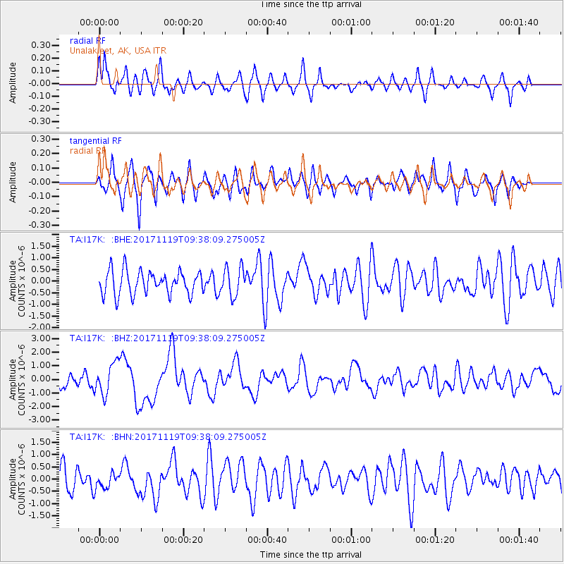
I17K Unalakleet, AK, USA - Earthquake Result Viewer
*The percent match for this event was below the threshold and hence no stack was calculated.
| Earthquake location: |
Loyalty Islands |
| Earthquake latitude/longitude: |
-21.7/168.7 |
| Earthquake time(UTC): |
2017/11/19 (323) 09:25:47 GMT |
| Earthquake Depth: |
4.0 km |
| Earthquake Magnitude: |
6.3 mww |
| Earthquake Catalog/Contributor: |
NEIC PDE/us |
|
| Network: |
TA USArray Transportable Network (new EarthScope stations) |
| Station: |
I17K Unalakleet, AK, USA |
| Lat/Lon: |
63.89 N/160.70 W |
| Elevation: |
105 m |
|
| Distance: |
88.5 deg |
| Az: |
13.025 deg |
| Baz: |
208.28 deg |
| Ray Param: |
$rayparam |
*The percent match for this event was below the threshold and hence was not used in the summary stack. |
|
| Radial Match: |
59.24852 % |
| Radial Bump: |
400 |
| Transverse Match: |
58.366123 % |
| Transverse Bump: |
400 |
| SOD ConfigId: |
13570011 |
| Insert Time: |
2019-04-29 06:47:40.570 +0000 |
| GWidth: |
2.5 |
| Max Bumps: |
400 |
| Tol: |
0.001 |
|
Signal To Noise
| Channel | StoN | STA | LTA |
| TA:I17K: :BHZ:20171119T09:38:09.275005Z | 2.2289991 | 1.1799847E-6 | 5.293787E-7 |
| TA:I17K: :BHN:20171119T09:38:09.275005Z | 0.62911046 | 2.8889045E-7 | 4.5920464E-7 |
| TA:I17K: :BHE:20171119T09:38:09.275005Z | 1.2313632 | 6.203658E-7 | 5.0380413E-7 |
| Arrivals |
| Ps | |
| PpPs | |
| PsPs/PpSs | |


