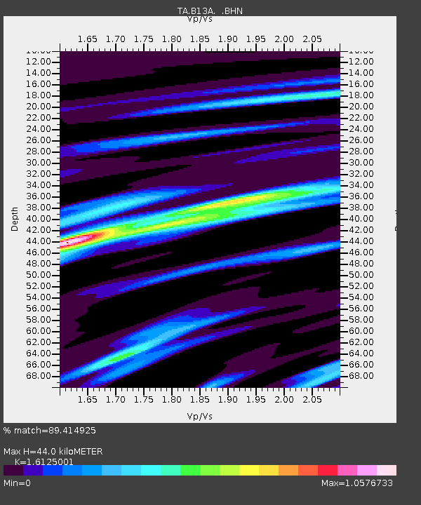
B13A Whitefish, MT, USA - Earthquake Result Viewer
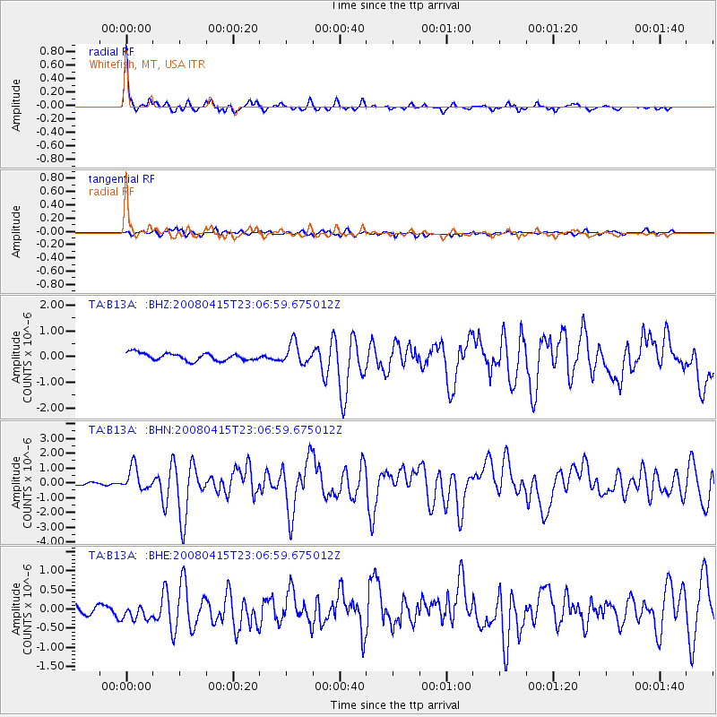
Earthquake location: Andreanof Islands, Aleutian Is.
Earthquake latitude/longitude: 51.9/-179.4
Earthquake time(UTC): 2008/04/15 (106) 22:59:51 GMT
Earthquake Depth: 10 km
Earthquake Magnitude: 6.1 MB, 6.4 MS, 6.4 MW, 6.4 MW
Earthquake Catalog/Contributor: WHDF/NEIC
Network: TA USArray Transportable Network (new EarthScope stations)
Station: B13A Whitefish, MT, USA
Lat/Lon: 48.37 N/114.47 W
Elevation: 933 m
Distance: 40.5 deg
Az: 68.297 deg
Baz: 300.199 deg
Ray Param: 0.07434978
Estimated Moho Depth: 44.0 km
Estimated Crust Vp/Vs: 1.61
Assumed Crust Vp: 6.622 km/s
Estimated Crust Vs: 4.107 km/s
Estimated Crust Poisson's Ratio: 0.19
Radial Match: 89.414925 %
Radial Bump: 292
Transverse Match: 71.57094 %
Transverse Bump: 400
SOD ConfigId: 2504
Insert Time: 2010-03-06 06:47:23.335 +0000
GWidth: 2.5
Max Bumps: 400
Tol: 0.001

Signal To Noise

ChannelStoNSTALTA
TA:B13A: :BHN:20080415T23:06:59.675012Z7.9398897.898509E-79.947883E-8
TA:B13A: :BHE:20080415T23:06:59.675012Z1.58693652.4265634E-71.5290867E-7
TA:B13A: :BHZ:20080415T23:06:59.675012Z2.8562024.0987368E-71.4350304E-7
Arrivals
Ps4.4 SECOND
PpPs16 SECOND
PsPs/PpSs20 SECOND