B13A Whitefish, MT, USA - Earthquake Result Viewer
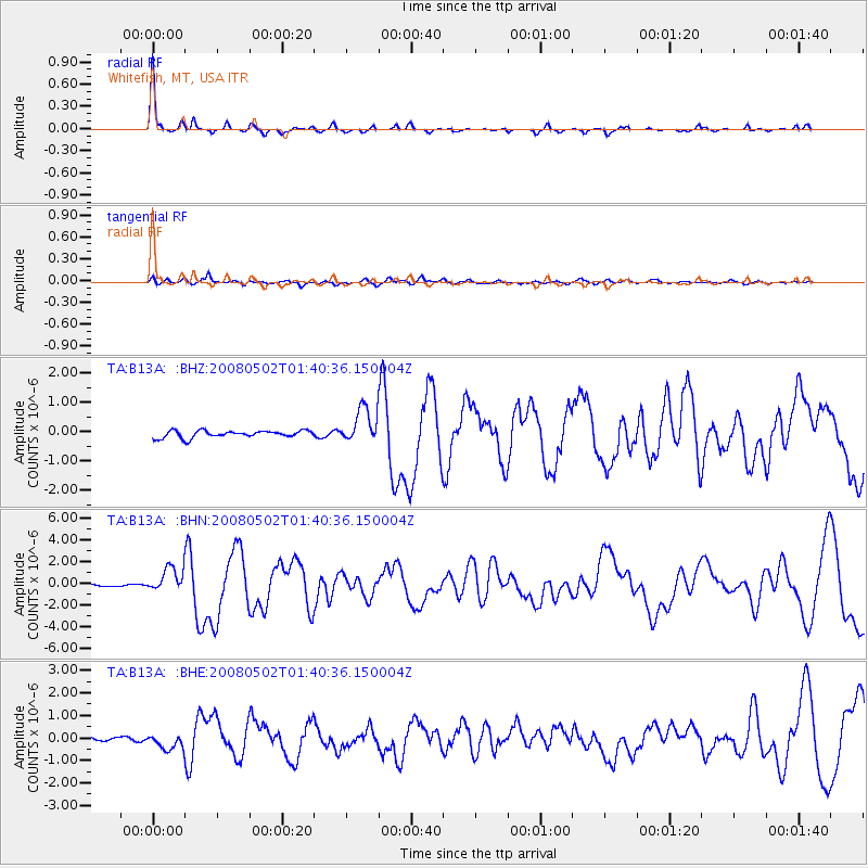
Earthquake location: Andreanof Islands, Aleutian Is.
Earthquake latitude/longitude: 51.9/-177.5
Earthquake time(UTC): 2008/05/02 (123) 01:33:37 GMT
Earthquake Depth: 14 km
Earthquake Magnitude: 6.3 MB, 6.8 MS, 6.6 MW, 6.6 MW
Earthquake Catalog/Contributor: WHDF/NEIC
Network: TA USArray Transportable Network (new EarthScope stations)
Station: B13A Whitefish, MT, USA
Lat/Lon: 48.37 N/114.47 W
Elevation: 933 m
Distance: 39.5 deg
Az: 69.254 deg
Baz: 299.575 deg
Ray Param: 0.074958086
Estimated Moho Depth: 41.25 km
Estimated Crust Vp/Vs: 1.69
Assumed Crust Vp: 6.622 km/s
Estimated Crust Vs: 3.93 km/s
Estimated Crust Poisson's Ratio: 0.23
Radial Match: 92.05499 %
Radial Bump: 217
Transverse Match: 68.38374 %
Transverse Bump: 400
SOD ConfigId: 2504
Insert Time: 2010-03-06 06:47:28.086 +0000
GWidth: 2.5
Max Bumps: 400
Tol: 0.001

Signal To Noise

ChannelStoNSTALTA
TA:B13A: :BHN:20080502T01:40:36.150004Z11.0371511.1309357E-61.02466274E-7
TA:B13A: :BHE:20080502T01:40:36.150004Z4.09257943.5005294E-78.553358E-8
TA:B13A: :BHZ:20080502T01:40:36.150004Z4.933915.9847446E-71.2129823E-7
Arrivals
Ps4.6 SECOND
PpPs15 SECOND
PsPs/PpSs20 SECOND