You are here: Home > Network List > TA - USArray Transportable Network (new EarthScope stations) Stations List
> Station M11K Mekoryuk, AK, USA > Earthquake Result Viewer
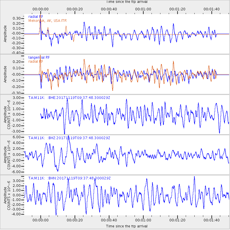
M11K Mekoryuk, AK, USA - Earthquake Result Viewer
*The percent match for this event was below the threshold and hence no stack was calculated.
| Earthquake location: |
Loyalty Islands |
| Earthquake latitude/longitude: |
-21.7/168.7 |
| Earthquake time(UTC): |
2017/11/19 (323) 09:25:47 GMT |
| Earthquake Depth: |
4.0 km |
| Earthquake Magnitude: |
6.3 mww |
| Earthquake Catalog/Contributor: |
NEIC PDE/us |
|
| Network: |
TA USArray Transportable Network (new EarthScope stations) |
| Station: |
M11K Mekoryuk, AK, USA |
| Lat/Lon: |
60.38 N/166.20 W |
| Elevation: |
3.0 m |
|
| Distance: |
84.3 deg |
| Az: |
12.225 deg |
| Baz: |
203.366 deg |
| Ray Param: |
$rayparam |
*The percent match for this event was below the threshold and hence was not used in the summary stack. |
|
| Radial Match: |
60.94355 % |
| Radial Bump: |
400 |
| Transverse Match: |
52.305565 % |
| Transverse Bump: |
400 |
| SOD ConfigId: |
13570011 |
| Insert Time: |
2019-04-29 06:48:04.277 +0000 |
| GWidth: |
2.5 |
| Max Bumps: |
400 |
| Tol: |
0.001 |
|
Signal To Noise
| Channel | StoN | STA | LTA |
| TA:M11K: :BHZ:20171119T09:37:48.300029Z | 2.5293486 | 2.2560946E-6 | 8.919666E-7 |
| TA:M11K: :BHN:20171119T09:37:48.300029Z | 1.1653029 | 1.1677831E-6 | 1.0021284E-6 |
| TA:M11K: :BHE:20171119T09:37:48.300029Z | 0.9538696 | 9.991529E-7 | 1.0474733E-6 |
| Arrivals |
| Ps | |
| PpPs | |
| PsPs/PpSs | |


