You are here: Home > Network List > TA - USArray Transportable Network (new EarthScope stations) Stations List
> Station R18K Karluk, AK, USA > Earthquake Result Viewer
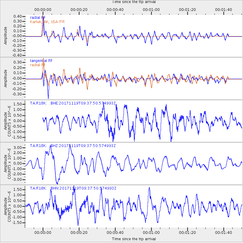
R18K Karluk, AK, USA - Earthquake Result Viewer
*The percent match for this event was below the threshold and hence no stack was calculated.
| Earthquake location: |
Loyalty Islands |
| Earthquake latitude/longitude: |
-21.7/168.7 |
| Earthquake time(UTC): |
2017/11/19 (323) 09:25:47 GMT |
| Earthquake Depth: |
4.0 km |
| Earthquake Magnitude: |
6.3 mww |
| Earthquake Catalog/Contributor: |
NEIC PDE/us |
|
| Network: |
TA USArray Transportable Network (new EarthScope stations) |
| Station: |
R18K Karluk, AK, USA |
| Lat/Lon: |
57.57 N/154.45 W |
| Elevation: |
39 m |
|
| Distance: |
84.7 deg |
| Az: |
18.938 deg |
| Baz: |
214.074 deg |
| Ray Param: |
$rayparam |
*The percent match for this event was below the threshold and hence was not used in the summary stack. |
|
| Radial Match: |
72.527405 % |
| Radial Bump: |
400 |
| Transverse Match: |
64.903564 % |
| Transverse Bump: |
400 |
| SOD ConfigId: |
13570011 |
| Insert Time: |
2019-04-29 06:48:41.649 +0000 |
| GWidth: |
2.5 |
| Max Bumps: |
400 |
| Tol: |
0.001 |
|
Signal To Noise
| Channel | StoN | STA | LTA |
| TA:R18K: :BHZ:20171119T09:37:50.574993Z | 6.6169972 | 2.2276254E-6 | 3.36652E-7 |
| TA:R18K: :BHN:20171119T09:37:50.574993Z | 1.8079689 | 6.0411156E-7 | 3.3413826E-7 |
| TA:R18K: :BHE:20171119T09:37:50.574993Z | 2.0042367 | 7.611522E-7 | 3.7977162E-7 |
| Arrivals |
| Ps | |
| PpPs | |
| PsPs/PpSs | |


