You are here: Home > Network List > UW - Pacific Northwest Regional Seismic Network Stations List
> Station MRBL Marblemount, WA, USA > Earthquake Result Viewer
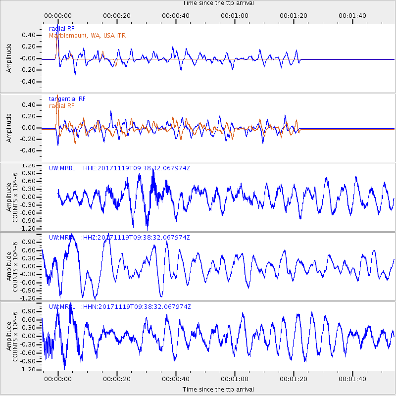
MRBL Marblemount, WA, USA - Earthquake Result Viewer
*The percent match for this event was below the threshold and hence no stack was calculated.
| Earthquake location: |
Loyalty Islands |
| Earthquake latitude/longitude: |
-21.7/168.7 |
| Earthquake time(UTC): |
2017/11/19 (323) 09:25:47 GMT |
| Earthquake Depth: |
4.0 km |
| Earthquake Magnitude: |
6.3 mww |
| Earthquake Catalog/Contributor: |
NEIC PDE/us |
|
| Network: |
UW Pacific Northwest Regional Seismic Network |
| Station: |
MRBL Marblemount, WA, USA |
| Lat/Lon: |
48.52 N/121.48 W |
| Elevation: |
75 m |
|
| Distance: |
93.5 deg |
| Az: |
38.696 deg |
| Baz: |
241.016 deg |
| Ray Param: |
$rayparam |
*The percent match for this event was below the threshold and hence was not used in the summary stack. |
|
| Radial Match: |
72.04687 % |
| Radial Bump: |
394 |
| Transverse Match: |
64.385735 % |
| Transverse Bump: |
400 |
| SOD ConfigId: |
13570011 |
| Insert Time: |
2019-04-29 06:49:36.526 +0000 |
| GWidth: |
2.5 |
| Max Bumps: |
400 |
| Tol: |
0.001 |
|
Signal To Noise
| Channel | StoN | STA | LTA |
| UW:MRBL: :HHZ:20171119T09:38:32.067974Z | 1.4991425 | 6.752324E-7 | 4.5041241E-7 |
| UW:MRBL: :HHN:20171119T09:38:32.067974Z | 1.5998068 | 6.6587836E-7 | 4.1622422E-7 |
| UW:MRBL: :HHE:20171119T09:38:32.067974Z | 2.1778266 | 5.2720645E-7 | 2.4207918E-7 |
| Arrivals |
| Ps | |
| PpPs | |
| PsPs/PpSs | |


