B13A Whitefish, MT, USA - Earthquake Result Viewer
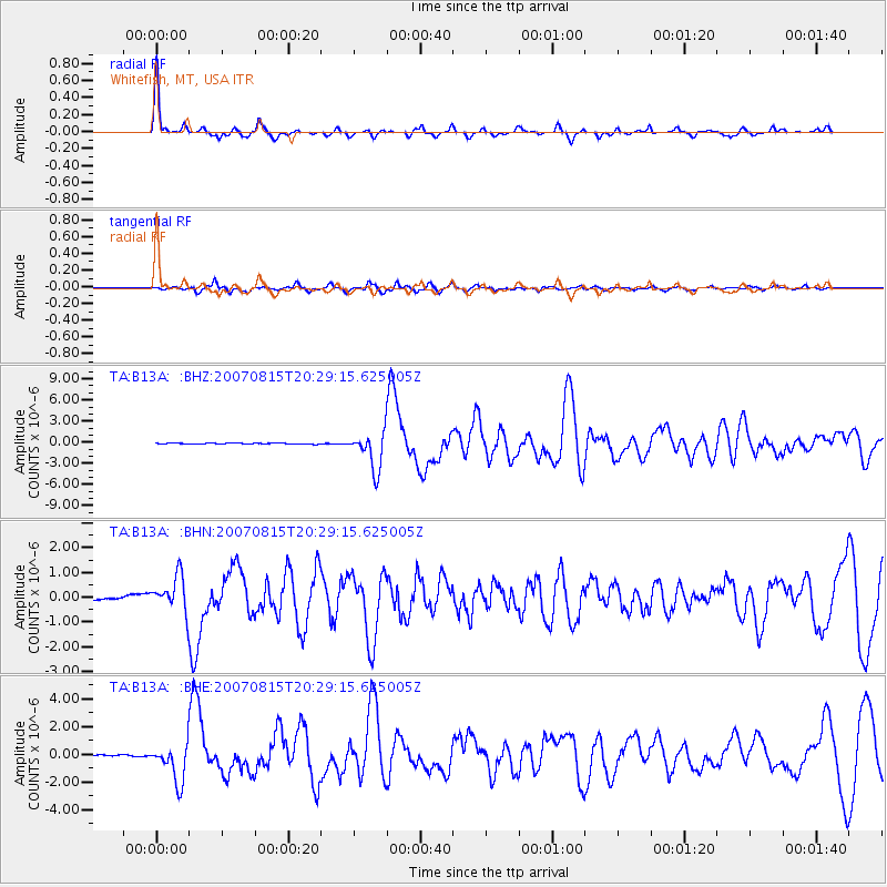
Earthquake location: Andreanof Islands, Aleutian Is.
Earthquake latitude/longitude: 50.3/-177.5
Earthquake time(UTC): 2007/08/15 (227) 20:22:11 GMT
Earthquake Depth: 9.0 km
Earthquake Magnitude: 6.3 MB, 6.2 MS, 6.4 MW, 5.9 ML
Earthquake Catalog/Contributor: WHDF/NEIC
Network: TA USArray Transportable Network (new EarthScope stations)
Station: B13A Whitefish, MT, USA
Lat/Lon: 48.37 N/114.47 W
Elevation: 933 m
Distance: 40.0 deg
Az: 67.518 deg
Baz: 297.337 deg
Ray Param: 0.074624225
Estimated Moho Depth: 43.25 km
Estimated Crust Vp/Vs: 1.61
Assumed Crust Vp: 6.622 km/s
Estimated Crust Vs: 4.113 km/s
Estimated Crust Poisson's Ratio: 0.19
Radial Match: 91.03367 %
Radial Bump: 305
Transverse Match: 84.83102 %
Transverse Bump: 400
SOD ConfigId: 2564
Insert Time: 2010-03-06 06:49:43.966 +0000
GWidth: 2.5
Max Bumps: 400
Tol: 0.001

Signal To Noise

ChannelStoNSTALTA
TA:B13A: :BHN:20070815T20:29:15.625005Z12.007256.9952233E-75.8258333E-8
TA:B13A: :BHE:20070815T20:29:15.625005Z34.6037181.3749269E-63.97335E-8
TA:B13A: :BHZ:20070815T20:29:15.625005Z44.8844262.672674E-65.9545695E-8
Arrivals
Ps4.3 SECOND
PpPs16 SECOND
PsPs/PpSs20 SECOND