
B13A Whitefish, MT, USA - Earthquake Result Viewer
| ||||||||||||||||||
| ||||||||||||||||||
| ||||||||||||||||||
|
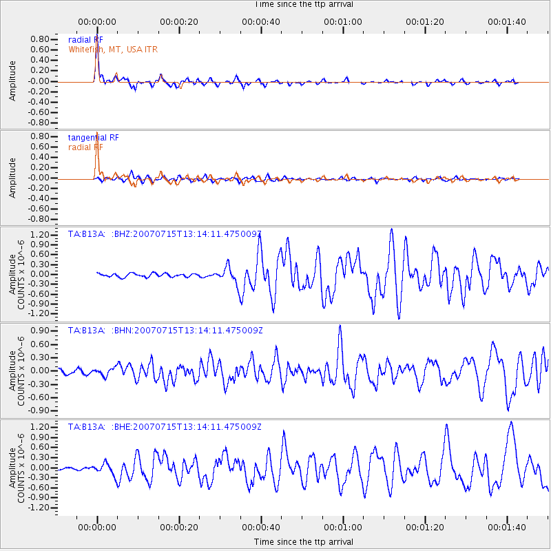
Signal To Noise
| Channel | StoN | STA | LTA |
| TA:B13A: :BHN:20070715T13:14:11.475009Z | 1.5027312 | 8.5604434E-8 | 5.6965902E-8 |
| TA:B13A: :BHE:20070715T13:14:11.475009Z | 4.097735 | 1.772624E-7 | 4.325863E-8 |
| TA:B13A: :BHZ:20070715T13:14:11.475009Z | 5.307812 | 2.7280834E-7 | 5.1397507E-8 |
| Arrivals | |
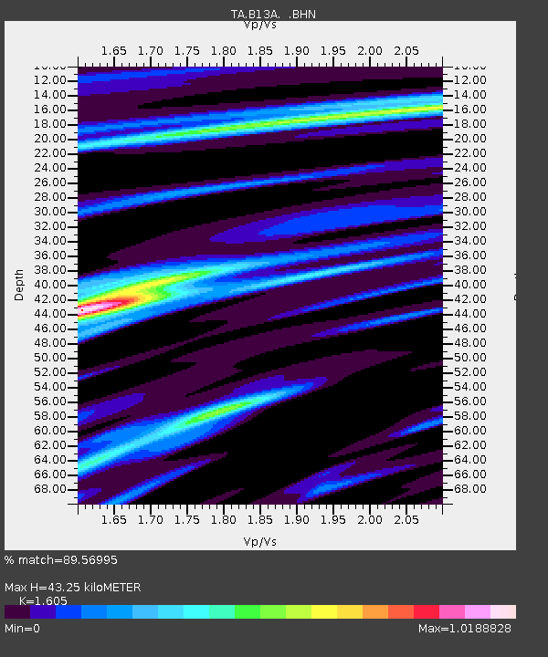
| Ps | 4.3 SECOND |
| PpPs | 16 SECOND |
| PsPs/PpSs | 20 SECOND |

