B13A Whitefish, MT, USA - Earthquake Result Viewer
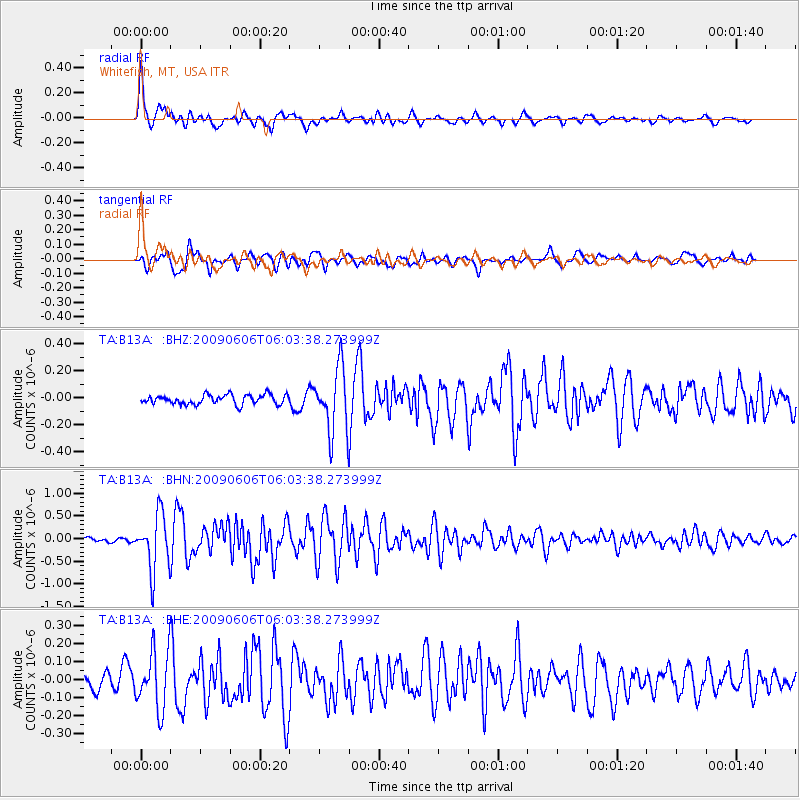
Earthquake location: Near East Coast Of Honshu, Japan
Earthquake latitude/longitude: 35.5/140.9
Earthquake time(UTC): 2009/06/06 (157) 05:52:43 GMT
Earthquake Depth: 34 km
Earthquake Magnitude: 5.8 MB, 5.4 MS, 5.8 MW, 5.7 MW
Earthquake Catalog/Contributor: WHDF/NEIC
Network: TA USArray Transportable Network (new EarthScope stations)
Station: B13A Whitefish, MT, USA
Lat/Lon: 48.37 N/114.47 W
Elevation: 933 m
Distance: 72.9 deg
Az: 42.443 deg
Baz: 304.305 deg
Ray Param: 0.05327985
Estimated Moho Depth: 23.5 km
Estimated Crust Vp/Vs: 1.86
Assumed Crust Vp: 6.622 km/s
Estimated Crust Vs: 3.565 km/s
Estimated Crust Poisson's Ratio: 0.30
Radial Match: 88.29389 %
Radial Bump: 366
Transverse Match: 79.70053 %
Transverse Bump: 400
SOD ConfigId: 2648
Insert Time: 2010-03-06 06:50:21.348 +0000
GWidth: 2.5
Max Bumps: 400
Tol: 0.001

Signal To Noise

ChannelStoNSTALTA
TA:B13A: :BHN:20090606T06:03:38.273999Z20.842296.1592453E-72.9551671E-8
TA:B13A: :BHE:20090606T06:03:38.273999Z3.75905351.62227E-74.315634E-8
TA:B13A: :BHZ:20090606T06:03:38.273999Z6.74178842.3823877E-73.533762E-8
Arrivals
Ps3.2 SECOND
PpPs9.8 SECOND
PsPs/PpSs13 SECOND