You are here: Home > Network List > TA - USArray Transportable Network (new EarthScope stations) Stations List
> Station A21K Barrow, AK, USA > Earthquake Result Viewer
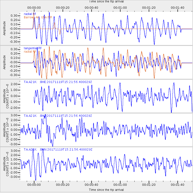
A21K Barrow, AK, USA - Earthquake Result Viewer
*The percent match for this event was below the threshold and hence no stack was calculated.
| Earthquake location: |
Loyalty Islands |
| Earthquake latitude/longitude: |
-21.5/168.5 |
| Earthquake time(UTC): |
2017/11/19 (323) 15:09:03 GMT |
| Earthquake Depth: |
14 km |
| Earthquake Magnitude: |
6.6 mww |
| Earthquake Catalog/Contributor: |
NEIC PDE/us |
|
| Network: |
TA USArray Transportable Network (new EarthScope stations) |
| Station: |
A21K Barrow, AK, USA |
| Lat/Lon: |
71.32 N/156.62 W |
| Elevation: |
577 m |
|
| Distance: |
95.7 deg |
| Az: |
10.659 deg |
| Baz: |
212.315 deg |
| Ray Param: |
$rayparam |
*The percent match for this event was below the threshold and hence was not used in the summary stack. |
|
| Radial Match: |
64.29202 % |
| Radial Bump: |
400 |
| Transverse Match: |
46.986706 % |
| Transverse Bump: |
400 |
| SOD ConfigId: |
13570011 |
| Insert Time: |
2019-04-29 06:55:40.904 +0000 |
| GWidth: |
2.5 |
| Max Bumps: |
400 |
| Tol: |
0.001 |
|
Signal To Noise
| Channel | StoN | STA | LTA |
| TA:A21K: :BHZ:20171119T15:21:56.400029Z | 1.1115942 | 8.792318E-7 | 7.9096475E-7 |
| TA:A21K: :BHN:20171119T15:21:56.400029Z | 3.467341 | 2.3328114E-6 | 6.727955E-7 |
| TA:A21K: :BHE:20171119T15:21:56.400029Z | 0.8080477 | 7.3206263E-7 | 9.0596467E-7 |
| Arrivals |
| Ps | |
| PpPs | |
| PsPs/PpSs | |


