You are here: Home > Network List > TA - USArray Transportable Network (new EarthScope stations) Stations List
> Station F26K Sheenjek River, AK, USA > Earthquake Result Viewer
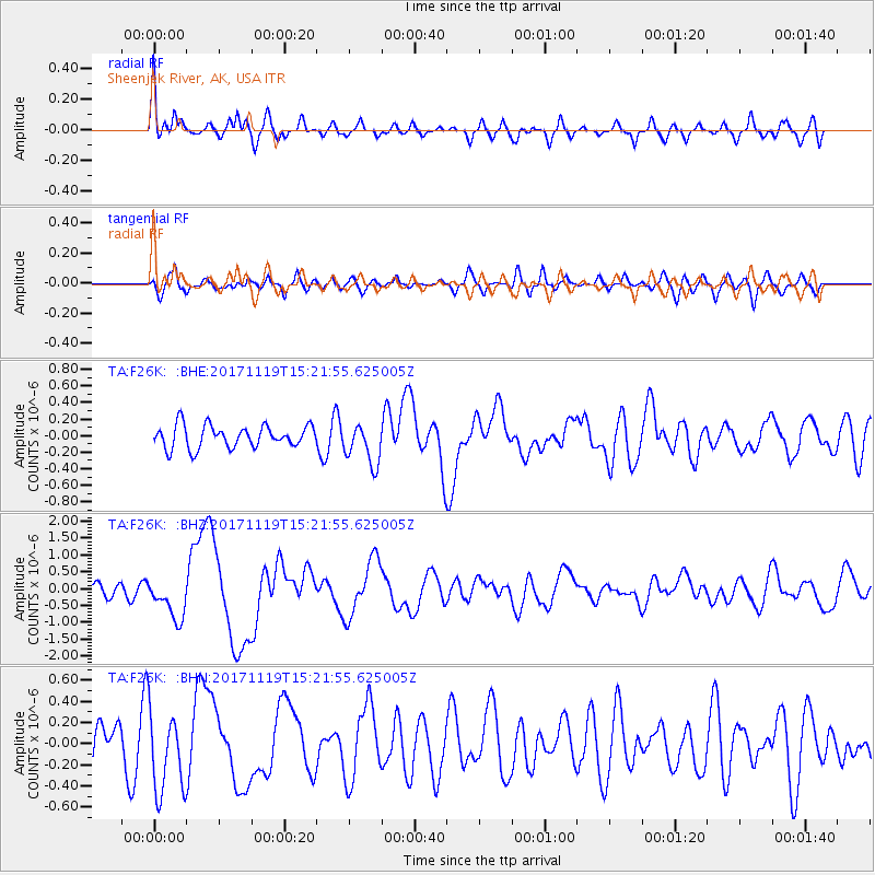
F26K Sheenjek River, AK, USA - Earthquake Result Viewer
*The percent match for this event was below the threshold and hence no stack was calculated.
| Earthquake location: |
Loyalty Islands |
| Earthquake latitude/longitude: |
-21.5/168.5 |
| Earthquake time(UTC): |
2017/11/19 (323) 15:09:03 GMT |
| Earthquake Depth: |
14 km |
| Earthquake Magnitude: |
6.6 mww |
| Earthquake Catalog/Contributor: |
NEIC PDE/us |
|
| Network: |
TA USArray Transportable Network (new EarthScope stations) |
| Station: |
F26K Sheenjek River, AK, USA |
| Lat/Lon: |
67.69 N/144.15 W |
| Elevation: |
683 m |
|
| Distance: |
95.5 deg |
| Az: |
16.373 deg |
| Baz: |
223.442 deg |
| Ray Param: |
$rayparam |
*The percent match for this event was below the threshold and hence was not used in the summary stack. |
|
| Radial Match: |
74.08409 % |
| Radial Bump: |
400 |
| Transverse Match: |
56.75362 % |
| Transverse Bump: |
400 |
| SOD ConfigId: |
13570011 |
| Insert Time: |
2019-04-29 06:56:03.294 +0000 |
| GWidth: |
2.5 |
| Max Bumps: |
400 |
| Tol: |
0.001 |
|
Signal To Noise
| Channel | StoN | STA | LTA |
| TA:F26K: :BHZ:20171119T15:21:55.625005Z | 2.5834987 | 6.074533E-7 | 2.3512816E-7 |
| TA:F26K: :BHN:20171119T15:21:55.625005Z | 1.4375045 | 3.8400086E-7 | 2.671302E-7 |
| TA:F26K: :BHE:20171119T15:21:55.625005Z | 1.8345633 | 2.4770696E-7 | 1.350223E-7 |
| Arrivals |
| Ps | |
| PpPs | |
| PsPs/PpSs | |


