B13A Whitefish, MT, USA - Earthquake Result Viewer
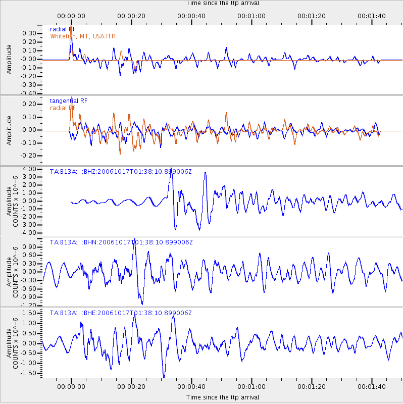
Earthquake location: New Britain Region, P.N.G.
Earthquake latitude/longitude: -5.9/151.0
Earthquake time(UTC): 2006/10/17 (290) 01:25:12 GMT
Earthquake Depth: 32 km
Earthquake Magnitude: 6.4 MB, 6.9 MS, 6.7 MW, 6.6 MW
Earthquake Catalog/Contributor: WHDF/NEIC
Network: TA USArray Transportable Network (new EarthScope stations)
Station: B13A Whitefish, MT, USA
Lat/Lon: 48.37 N/114.47 W
Elevation: 933 m
Distance: 97.4 deg
Az: 42.083 deg
Baz: 269.477 deg
Ray Param: 0.04021577
Estimated Moho Depth: 20.0 km
Estimated Crust Vp/Vs: 2.02
Assumed Crust Vp: 6.622 km/s
Estimated Crust Vs: 3.282 km/s
Estimated Crust Poisson's Ratio: 0.34
Radial Match: 86.61305 %
Radial Bump: 330
Transverse Match: 72.52617 %
Transverse Bump: 400
SOD ConfigId: 2665
Insert Time: 2010-03-06 06:50:59.484 +0000
GWidth: 2.5
Max Bumps: 400
Tol: 0.001

Signal To Noise

ChannelStoNSTALTA
TA:B13A: :BHN:20061017T01:38:10.899006Z0.477296351.42462E-72.9847703E-7
TA:B13A: :BHE:20061017T01:38:10.899006Z2.62379775.2688193E-72.008089E-7
TA:B13A: :BHZ:20061017T01:38:10.899006Z9.2289982.003832E-62.1712344E-7
Arrivals
Ps3.1 SECOND
PpPs9.0 SECOND
PsPs/PpSs12 SECOND