You are here: Home > Network List > TA - USArray Transportable Network (new EarthScope stations) Stations List
> Station B13A Whitefish, MT, USA > Earthquake Result Viewer
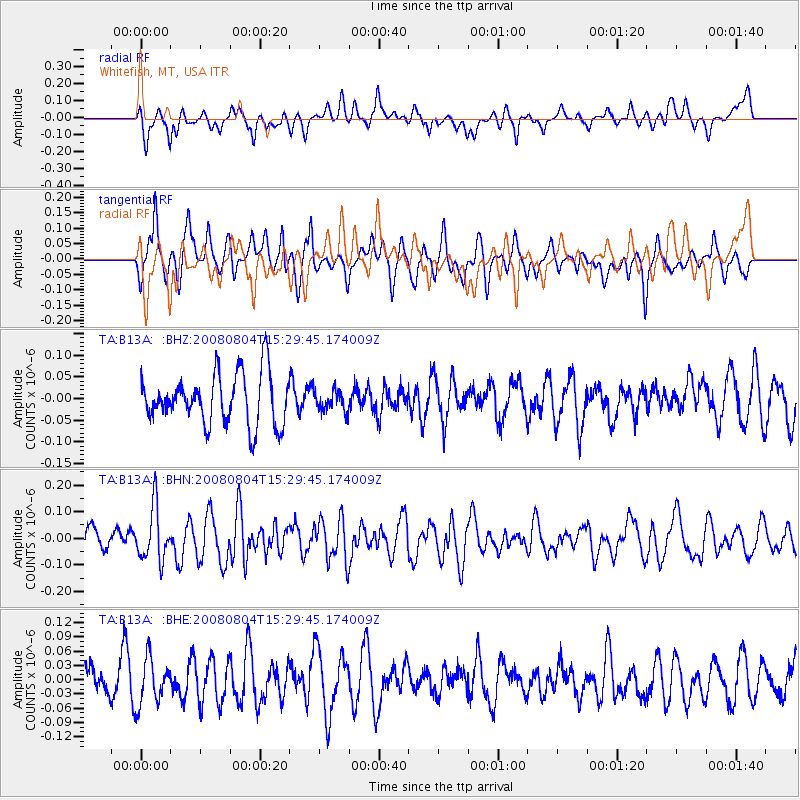
B13A Whitefish, MT, USA - Earthquake Result Viewer
*The percent match for this event was below the threshold and hence no stack was calculated.
| Earthquake location: |
New Britain Region, P.N.G. |
| Earthquake latitude/longitude: |
-5.1/151.8 |
| Earthquake time(UTC): |
2008/08/04 (217) 15:16:53 GMT |
| Earthquake Depth: |
45 km |
| Earthquake Magnitude: |
5.5 MW, 4.8 MS, 5.2 MB |
| Earthquake Catalog/Contributor: |
WHDF/NEIC |
|
| Network: |
TA USArray Transportable Network (new EarthScope stations) |
| Station: |
B13A Whitefish, MT, USA |
| Lat/Lon: |
48.37 N/114.47 W |
| Elevation: |
933 m |
|
| Distance: |
96.2 deg |
| Az: |
42.013 deg |
| Baz: |
269.422 deg |
| Ray Param: |
$rayparam |
*The percent match for this event was below the threshold and hence was not used in the summary stack. |
|
| Radial Match: |
46.272797 % |
| Radial Bump: |
400 |
| Transverse Match: |
57.90778 % |
| Transverse Bump: |
400 |
| SOD ConfigId: |
2504 |
| Insert Time: |
2010-03-06 06:51:10.780 +0000 |
| GWidth: |
2.5 |
| Max Bumps: |
400 |
| Tol: |
0.001 |
|
Signal To Noise
| Channel | StoN | STA | LTA |
| TA:B13A: :BHN:20080804T15:29:45.174009Z | 2.2352629 | 1.00255626E-7 | 4.485183E-8 |
| TA:B13A: :BHE:20080804T15:29:45.174009Z | 1.824979 | 4.791791E-8 | 2.6256695E-8 |
| TA:B13A: :BHZ:20080804T15:29:45.174009Z | 0.40798476 | 2.3720787E-8 | 5.8141357E-8 |
| Arrivals |
| Ps | |
| PpPs | |
| PsPs/PpSs | |


