You are here: Home > Network List > TA - USArray Transportable Network (new EarthScope stations) Stations List
> Station B13A Whitefish, MT, USA > Earthquake Result Viewer
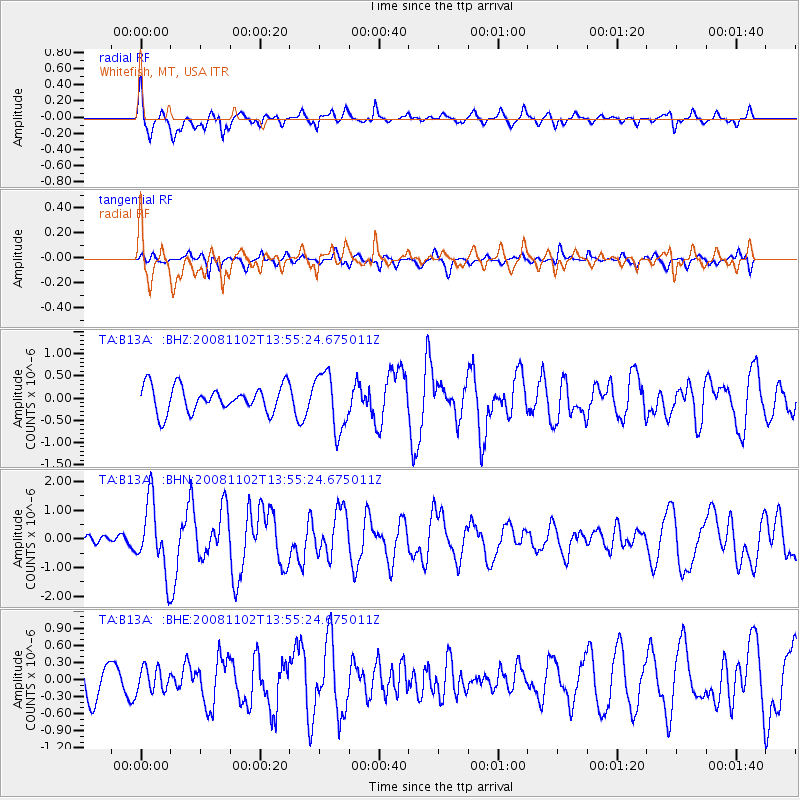
B13A Whitefish, MT, USA - Earthquake Result Viewer
*The percent match for this event was below the threshold and hence no stack was calculated.
| Earthquake location: |
Andreanof Islands, Aleutian Is. |
| Earthquake latitude/longitude: |
51.6/-174.4 |
| Earthquake time(UTC): |
2008/11/02 (307) 13:48:42 GMT |
| Earthquake Depth: |
36 km |
| Earthquake Magnitude: |
5.7 MB, 5.8 MS, 6.1 MW, 6.1 MW |
| Earthquake Catalog/Contributor: |
WHDF/NEIC |
|
| Network: |
TA USArray Transportable Network (new EarthScope stations) |
| Station: |
B13A Whitefish, MT, USA |
| Lat/Lon: |
48.37 N/114.47 W |
| Elevation: |
933 m |
|
| Distance: |
37.7 deg |
| Az: |
70.514 deg |
| Baz: |
298.02 deg |
| Ray Param: |
$rayparam |
*The percent match for this event was below the threshold and hence was not used in the summary stack. |
|
| Radial Match: |
75.821 % |
| Radial Bump: |
400 |
| Transverse Match: |
59.810265 % |
| Transverse Bump: |
313 |
| SOD ConfigId: |
2658 |
| Insert Time: |
2010-03-06 06:51:13.396 +0000 |
| GWidth: |
2.5 |
| Max Bumps: |
400 |
| Tol: |
0.001 |
|
Signal To Noise
| Channel | StoN | STA | LTA |
| TA:B13A: :BHN:20081102T13:55:24.675011Z | 3.9144626 | 1.215291E-6 | 3.104618E-7 |
| TA:B13A: :BHE:20081102T13:55:24.675011Z | 1.0059822 | 2.0612626E-7 | 2.0490052E-7 |
| TA:B13A: :BHZ:20081102T13:55:24.675011Z | 2.192082 | 6.402334E-7 | 2.9206635E-7 |
| Arrivals |
| Ps | |
| PpPs | |
| PsPs/PpSs | |


