You are here: Home > Network List > TA - USArray Transportable Network (new EarthScope stations) Stations List
> Station B13A Whitefish, MT, USA > Earthquake Result Viewer
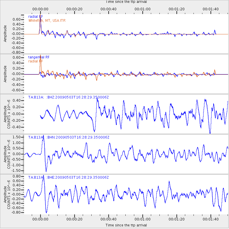
B13A Whitefish, MT, USA - Earthquake Result Viewer
*The percent match for this event was below the threshold and hence no stack was calculated.
| Earthquake location: |
Guatemala |
| Earthquake latitude/longitude: |
14.6/-91.2 |
| Earthquake time(UTC): |
2009/05/03 (123) 16:21:47 GMT |
| Earthquake Depth: |
124 km |
| Earthquake Magnitude: |
5.6 MB, 6.2 MW, 6.2 MW |
| Earthquake Catalog/Contributor: |
WHDF/NEIC |
|
| Network: |
TA USArray Transportable Network (new EarthScope stations) |
| Station: |
B13A Whitefish, MT, USA |
| Lat/Lon: |
48.37 N/114.47 W |
| Elevation: |
933 m |
|
| Distance: |
38.8 deg |
| Az: |
335.115 deg |
| Baz: |
142.332 deg |
| Ray Param: |
$rayparam |
*The percent match for this event was below the threshold and hence was not used in the summary stack. |
|
| Radial Match: |
77.83363 % |
| Radial Bump: |
392 |
| Transverse Match: |
66.63301 % |
| Transverse Bump: |
400 |
| SOD ConfigId: |
2658 |
| Insert Time: |
2010-03-06 06:51:15.196 +0000 |
| GWidth: |
2.5 |
| Max Bumps: |
400 |
| Tol: |
0.001 |
|
Signal To Noise
| Channel | StoN | STA | LTA |
| TA:B13A: :BHN:20090503T16:28:29.350006Z | 6.648902 | 8.9210187E-7 | 1.3417281E-7 |
| TA:B13A: :BHE:20090503T16:28:29.350006Z | 4.3410735 | 4.8792026E-7 | 1.12396215E-7 |
| TA:B13A: :BHZ:20090503T16:28:29.350006Z | 2.8568928 | 3.0997023E-7 | 1.0849908E-7 |
| Arrivals |
| Ps | |
| PpPs | |
| PsPs/PpSs | |


