You are here: Home > Network List > TA - USArray Transportable Network (new EarthScope stations) Stations List
> Station R17K Ugashik Creek, AK, USA > Earthquake Result Viewer
R17K Ugashik Creek, AK, USA - Earthquake Result Viewer

| Earthquake location: |
Loyalty Islands |
| Earthquake latitude/longitude: |
-21.5/168.5 |
| Earthquake time(UTC): |
2017/11/19 (323) 15:09:03 GMT |
| Earthquake Depth: |
14 km |
| Earthquake Magnitude: |
6.6 mww |
| Earthquake Catalog/Contributor: |
NEIC PDE/us |
|
| Network: |
TA USArray Transportable Network (new EarthScope stations) |
| Station: |
R17K Ugashik Creek, AK, USA |
| Lat/Lon: |
57.64 N/156.39 W |
| Elevation: |
273 m |
|
| Distance: |
84.1 deg |
| Az: |
18.098 deg |
| Baz: |
212.537 deg |
| Ray Param: |
0.045698356 |
| Estimated Moho Depth: |
17.75 km |
| Estimated Crust Vp/Vs: |
1.62 |
| Assumed Crust Vp: |
6.1 km/s |
| Estimated Crust Vs: |
3.76 km/s |
| Estimated Crust Poisson's Ratio: |
0.19 |
|
| Radial Match: |
86.50994 % |
| Radial Bump: |
400 |
| Transverse Match: |
73.77492 % |
| Transverse Bump: |
400 |
| SOD ConfigId: |
13570011 |
| Insert Time: |
2019-04-29 06:57:08.516 +0000 |
| GWidth: |
2.5 |
| Max Bumps: |
400 |
| Tol: |
0.001 |
|
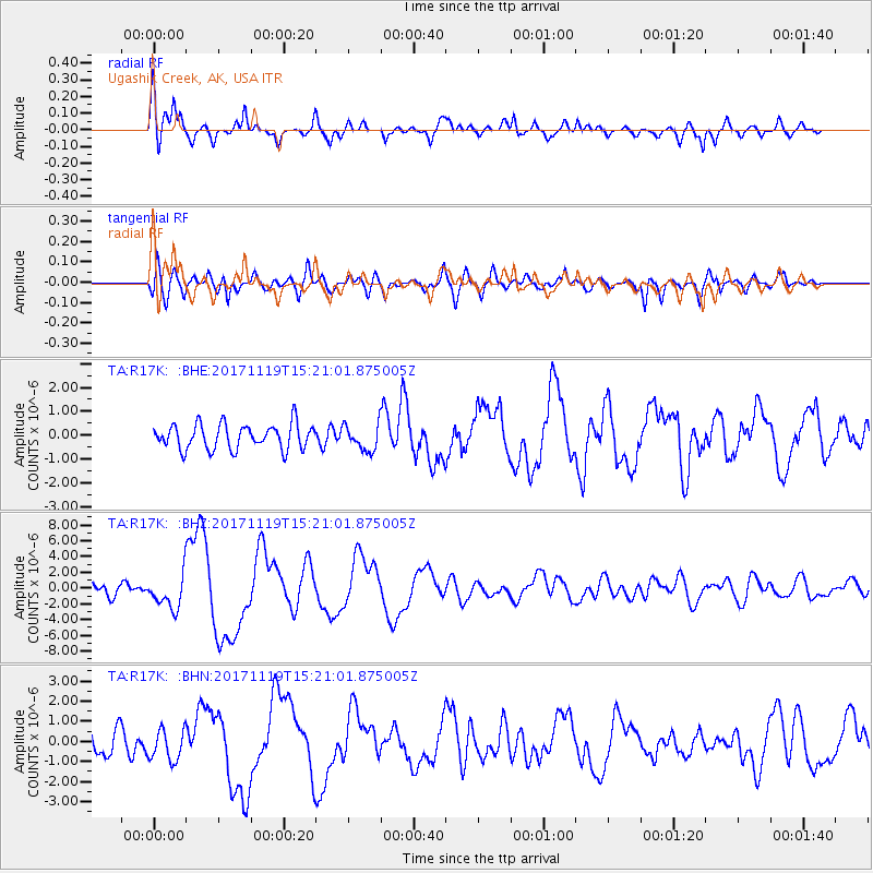
Signal To Noise
| Channel | StoN | STA | LTA |
| TA:R17K: :BHZ:20171119T15:21:01.875005Z | 3.594503 | 2.1255826E-6 | 5.9134254E-7 |
| TA:R17K: :BHN:20171119T15:21:01.875005Z | 1.3879433 | 7.734399E-7 | 5.5725616E-7 |
| TA:R17K: :BHE:20171119T15:21:01.875005Z | 1.0693814 | 5.600854E-7 | 5.237471E-7 |
| Arrivals |
| Ps | 1.9 SECOND |
| PpPs | 7.4 SECOND |
| PsPs/PpSs | 9.3 SECOND |


