You are here: Home > Network List > UW - Pacific Northwest Regional Seismic Network Stations List
> Station UMAT Pilot Rock, OR, USA > Earthquake Result Viewer
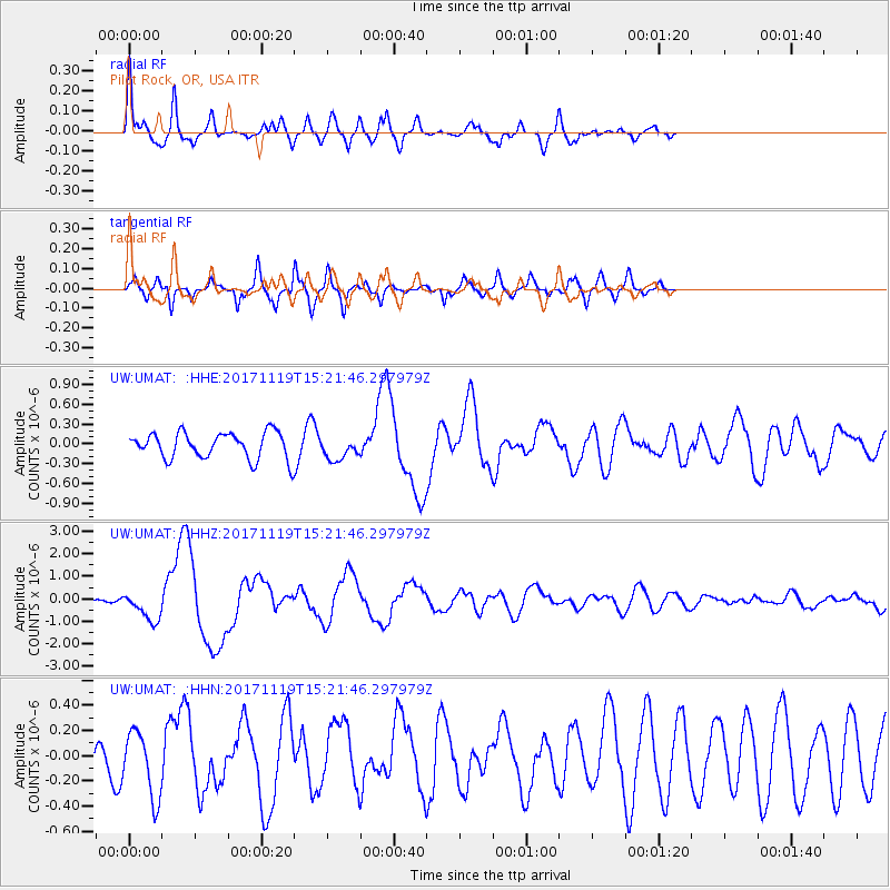
UMAT Pilot Rock, OR, USA - Earthquake Result Viewer
*The percent match for this event was below the threshold and hence no stack was calculated.
| Earthquake location: |
Loyalty Islands |
| Earthquake latitude/longitude: |
-21.5/168.5 |
| Earthquake time(UTC): |
2017/11/19 (323) 15:09:03 GMT |
| Earthquake Depth: |
14 km |
| Earthquake Magnitude: |
6.6 mww |
| Earthquake Catalog/Contributor: |
NEIC PDE/us |
|
| Network: |
UW Pacific Northwest Regional Seismic Network |
| Station: |
UMAT Pilot Rock, OR, USA |
| Lat/Lon: |
45.29 N/118.96 W |
| Elevation: |
1318 m |
|
| Distance: |
93.5 deg |
| Az: |
42.412 deg |
| Baz: |
242.833 deg |
| Ray Param: |
$rayparam |
*The percent match for this event was below the threshold and hence was not used in the summary stack. |
|
| Radial Match: |
79.933044 % |
| Radial Bump: |
307 |
| Transverse Match: |
65.3145 % |
| Transverse Bump: |
371 |
| SOD ConfigId: |
13570011 |
| Insert Time: |
2019-04-29 06:57:56.841 +0000 |
| GWidth: |
2.5 |
| Max Bumps: |
400 |
| Tol: |
0.001 |
|
Signal To Noise
| Channel | StoN | STA | LTA |
| UW:UMAT: :HHZ:20171119T15:21:46.297979Z | 3.947302 | 6.560836E-7 | 1.6621064E-7 |
| UW:UMAT: :HHN:20171119T15:21:46.297979Z | 1.2394621 | 2.613929E-7 | 2.1089221E-7 |
| UW:UMAT: :HHE:20171119T15:21:46.297979Z | 0.8479732 | 1.7327882E-7 | 2.0434467E-7 |
| Arrivals |
| Ps | |
| PpPs | |
| PsPs/PpSs | |


