You are here: Home > Network List > UW - Pacific Northwest Regional Seismic Network Stations List
> Station YACT Amboy, WA, USA > Earthquake Result Viewer
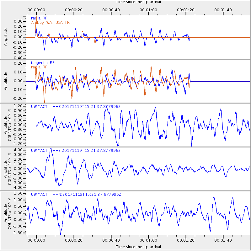
YACT Amboy, WA, USA - Earthquake Result Viewer
*The percent match for this event was below the threshold and hence no stack was calculated.
| Earthquake location: |
Loyalty Islands |
| Earthquake latitude/longitude: |
-21.5/168.5 |
| Earthquake time(UTC): |
2017/11/19 (323) 15:09:03 GMT |
| Earthquake Depth: |
14 km |
| Earthquake Magnitude: |
6.6 mww |
| Earthquake Catalog/Contributor: |
NEIC PDE/us |
|
| Network: |
UW Pacific Northwest Regional Seismic Network |
| Station: |
YACT Amboy, WA, USA |
| Lat/Lon: |
45.93 N/122.42 W |
| Elevation: |
211 m |
|
| Distance: |
91.6 deg |
| Az: |
40.692 deg |
| Baz: |
240.445 deg |
| Ray Param: |
$rayparam |
*The percent match for this event was below the threshold and hence was not used in the summary stack. |
|
| Radial Match: |
77.11225 % |
| Radial Bump: |
400 |
| Transverse Match: |
58.557228 % |
| Transverse Bump: |
400 |
| SOD ConfigId: |
13570011 |
| Insert Time: |
2019-04-29 06:57:58.610 +0000 |
| GWidth: |
2.5 |
| Max Bumps: |
400 |
| Tol: |
0.001 |
|
Signal To Noise
| Channel | StoN | STA | LTA |
| UW:YACT: :HHZ:20171119T15:21:37.877996Z | 2.680288 | 9.195205E-7 | 3.4306777E-7 |
| UW:YACT: :HHN:20171119T15:21:37.877996Z | 1.0303721 | 3.627833E-7 | 3.5208961E-7 |
| UW:YACT: :HHE:20171119T15:21:37.877996Z | 2.139879 | 4.2364456E-7 | 1.9797595E-7 |
| Arrivals |
| Ps | |
| PpPs | |
| PsPs/PpSs | |


