You are here: Home > Network List > TA - USArray Transportable Network (new EarthScope stations) Stations List
> Station O17K Koliganek, Bristol Bay, AK, USA > Earthquake Result Viewer
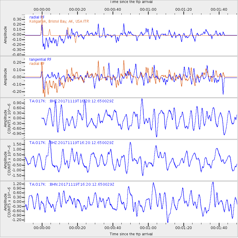
O17K Koliganek, Bristol Bay, AK, USA - Earthquake Result Viewer
*The percent match for this event was below the threshold and hence no stack was calculated.
| Earthquake location: |
Loyalty Islands |
| Earthquake latitude/longitude: |
-21.2/168.5 |
| Earthquake time(UTC): |
2017/11/19 (323) 16:08:06 GMT |
| Earthquake Depth: |
10 km |
| Earthquake Magnitude: |
5.9 Mww |
| Earthquake Catalog/Contributor: |
NEIC PDE/us |
|
| Network: |
TA USArray Transportable Network (new EarthScope stations) |
| Station: |
O17K Koliganek, Bristol Bay, AK, USA |
| Lat/Lon: |
59.77 N/157.09 W |
| Elevation: |
156 m |
|
| Distance: |
85.4 deg |
| Az: |
16.645 deg |
| Baz: |
211.888 deg |
| Ray Param: |
$rayparam |
*The percent match for this event was below the threshold and hence was not used in the summary stack. |
|
| Radial Match: |
62.439228 % |
| Radial Bump: |
400 |
| Transverse Match: |
50.006268 % |
| Transverse Bump: |
400 |
| SOD ConfigId: |
13570011 |
| Insert Time: |
2019-04-29 07:02:02.124 +0000 |
| GWidth: |
2.5 |
| Max Bumps: |
400 |
| Tol: |
0.001 |
|
Signal To Noise
| Channel | StoN | STA | LTA |
| TA:O17K: :BHZ:20171119T16:20:12.650029Z | 2.1939585 | 9.337437E-7 | 4.255977E-7 |
| TA:O17K: :BHN:20171119T16:20:12.650029Z | 0.77145004 | 2.92797E-7 | 3.7954112E-7 |
| TA:O17K: :BHE:20171119T16:20:12.650029Z | 0.7387711 | 3.241619E-7 | 4.3878535E-7 |
| Arrivals |
| Ps | |
| PpPs | |
| PsPs/PpSs | |


