You are here: Home > Network List > TA - USArray Transportable Network (new EarthScope stations) Stations List
> Station B13A Whitefish, MT, USA > Earthquake Result Viewer
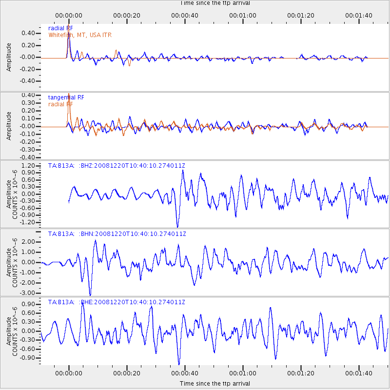
B13A Whitefish, MT, USA - Earthquake Result Viewer
*The percent match for this event was below the threshold and hence no stack was calculated.
| Earthquake location: |
Off East Coast Of Honshu, Japan |
| Earthquake latitude/longitude: |
36.5/142.4 |
| Earthquake time(UTC): |
2008/12/20 (355) 10:29:23 GMT |
| Earthquake Depth: |
19 km |
| Earthquake Magnitude: |
6.0 MB, 6.3 MS, 6.3 MW, 6.3 MW |
| Earthquake Catalog/Contributor: |
WHDF/NEIC |
|
| Network: |
TA USArray Transportable Network (new EarthScope stations) |
| Station: |
B13A Whitefish, MT, USA |
| Lat/Lon: |
48.37 N/114.47 W |
| Elevation: |
933 m |
|
| Distance: |
71.3 deg |
| Az: |
43.27 deg |
| Baz: |
304.116 deg |
| Ray Param: |
$rayparam |
*The percent match for this event was below the threshold and hence was not used in the summary stack. |
|
| Radial Match: |
78.512215 % |
| Radial Bump: |
347 |
| Transverse Match: |
61.156376 % |
| Transverse Bump: |
400 |
| SOD ConfigId: |
2658 |
| Insert Time: |
2010-03-06 06:53:03.762 +0000 |
| GWidth: |
2.5 |
| Max Bumps: |
400 |
| Tol: |
0.001 |
|
Signal To Noise
| Channel | StoN | STA | LTA |
| TA:B13A: :BHN:20081220T10:40:10.274011Z | 4.6838174 | 6.5441907E-7 | 1.3971916E-7 |
| TA:B13A: :BHE:20081220T10:40:10.274011Z | 1.7472125 | 4.0030073E-7 | 2.2910821E-7 |
| TA:B13A: :BHZ:20081220T10:40:10.274011Z | 1.2812977 | 1.9336422E-7 | 1.509128E-7 |
| Arrivals |
| Ps | |
| PpPs | |
| PsPs/PpSs | |


