You are here: Home > Network List > CI - Caltech Regional Seismic Network Stations List
> Station MPM Manuel Prospect Mine, California, USA > Earthquake Result Viewer
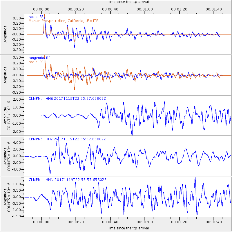
MPM Manuel Prospect Mine, California, USA - Earthquake Result Viewer
*The percent match for this event was below the threshold and hence no stack was calculated.
| Earthquake location: |
Loyalty Islands |
| Earthquake latitude/longitude: |
-21.3/168.5 |
| Earthquake time(UTC): |
2017/11/19 (323) 22:43:29 GMT |
| Earthquake Depth: |
25 km |
| Earthquake Magnitude: |
7.3 Mi |
| Earthquake Catalog/Contributor: |
NEIC PDE/at |
|
| Network: |
CI Caltech Regional Seismic Network |
| Station: |
MPM Manuel Prospect Mine, California, USA |
| Lat/Lon: |
36.06 N/117.49 W |
| Elevation: |
185 m |
|
| Distance: |
90.2 deg |
| Az: |
51.165 deg |
| Baz: |
243.694 deg |
| Ray Param: |
$rayparam |
*The percent match for this event was below the threshold and hence was not used in the summary stack. |
|
| Radial Match: |
90.134094 % |
| Radial Bump: |
400 |
| Transverse Match: |
82.18989 % |
| Transverse Bump: |
400 |
| SOD ConfigId: |
13570011 |
| Insert Time: |
2019-04-29 07:06:14.727 +0000 |
| GWidth: |
2.5 |
| Max Bumps: |
400 |
| Tol: |
0.001 |
|
Signal To Noise
| Channel | StoN | STA | LTA |
| CI:MPM: :HHZ:20171119T22:55:57.65802Z | 8.487997 | 1.022303E-6 | 1.20441E-7 |
| CI:MPM: :HHN:20171119T22:55:57.65802Z | 1.6358387 | 2.0942417E-7 | 1.280225E-7 |
| CI:MPM: :HHE:20171119T22:55:57.65802Z | 2.2570312 | 3.2630072E-7 | 1.4457075E-7 |
| Arrivals |
| Ps | |
| PpPs | |
| PsPs/PpSs | |


