You are here: Home > Network List > CI - Caltech Regional Seismic Network Stations List
> Station MPP McPhearson Peak > Earthquake Result Viewer
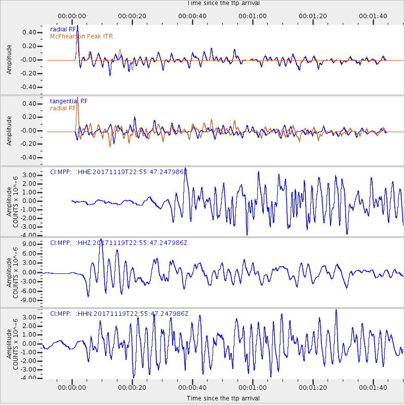
MPP McPhearson Peak - Earthquake Result Viewer
*The percent match for this event was below the threshold and hence no stack was calculated.
| Earthquake location: |
Loyalty Islands |
| Earthquake latitude/longitude: |
-21.3/168.5 |
| Earthquake time(UTC): |
2017/11/19 (323) 22:43:29 GMT |
| Earthquake Depth: |
25 km |
| Earthquake Magnitude: |
7.3 Mi |
| Earthquake Catalog/Contributor: |
NEIC PDE/at |
|
| Network: |
CI Caltech Regional Seismic Network |
| Station: |
MPP McPhearson Peak |
| Lat/Lon: |
34.89 N/119.81 W |
| Elevation: |
1739 m |
|
| Distance: |
88.0 deg |
| Az: |
51.344 deg |
| Baz: |
242.354 deg |
| Ray Param: |
$rayparam |
*The percent match for this event was below the threshold and hence was not used in the summary stack. |
|
| Radial Match: |
88.02271 % |
| Radial Bump: |
400 |
| Transverse Match: |
89.038086 % |
| Transverse Bump: |
400 |
| SOD ConfigId: |
13570011 |
| Insert Time: |
2019-04-29 07:06:15.834 +0000 |
| GWidth: |
2.5 |
| Max Bumps: |
400 |
| Tol: |
0.001 |
|
Signal To Noise
| Channel | StoN | STA | LTA |
| CI:MPP: :HHZ:20171119T22:55:47.247986Z | 7.934467 | 1.0866455E-6 | 1.3695255E-7 |
| CI:MPP: :HHN:20171119T22:55:47.247986Z | 1.0113091 | 3.7313274E-7 | 3.6896012E-7 |
| CI:MPP: :HHE:20171119T22:55:47.247986Z | 2.254545 | 3.8260737E-7 | 1.6970492E-7 |
| Arrivals |
| Ps | |
| PpPs | |
| PsPs/PpSs | |


