You are here: Home > Network List > TA - USArray Transportable Network (new EarthScope stations) Stations List
> Station B18K Kokolik River, AK, USA > Earthquake Result Viewer
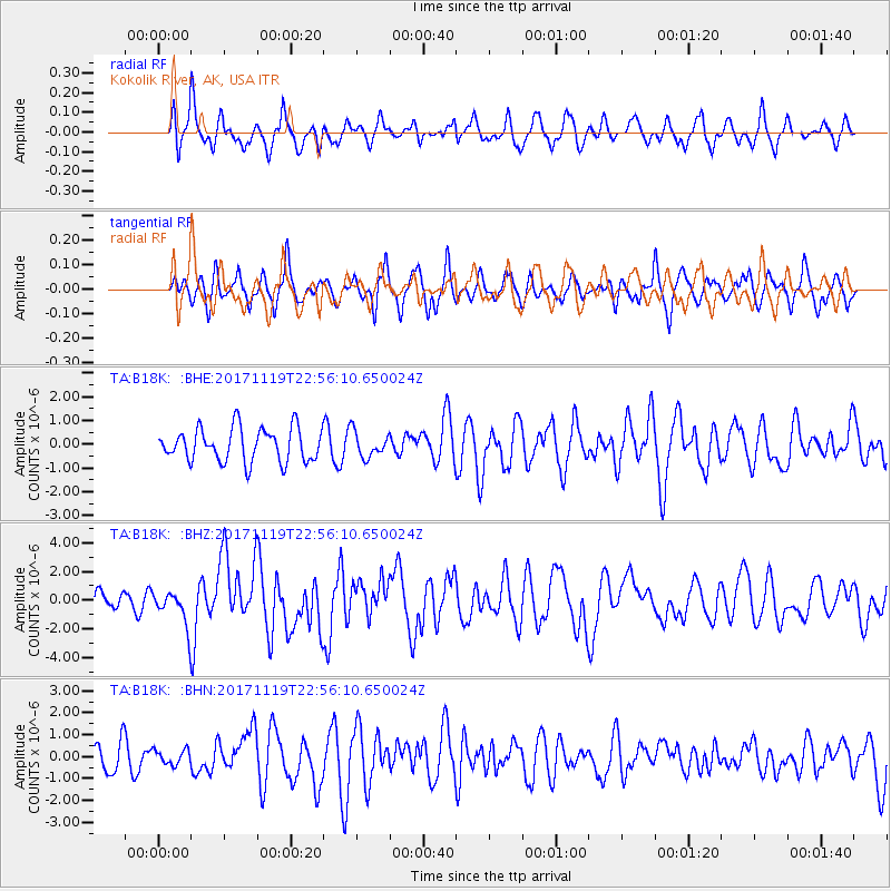
B18K Kokolik River, AK, USA - Earthquake Result Viewer
*The percent match for this event was below the threshold and hence no stack was calculated.
| Earthquake location: |
Loyalty Islands |
| Earthquake latitude/longitude: |
-21.3/168.5 |
| Earthquake time(UTC): |
2017/11/19 (323) 22:43:29 GMT |
| Earthquake Depth: |
25 km |
| Earthquake Magnitude: |
7.3 Mi |
| Earthquake Catalog/Contributor: |
NEIC PDE/at |
|
| Network: |
TA USArray Transportable Network (new EarthScope stations) |
| Station: |
B18K Kokolik River, AK, USA |
| Lat/Lon: |
69.36 N/161.80 W |
| Elevation: |
222 m |
|
| Distance: |
92.9 deg |
| Az: |
10.129 deg |
| Baz: |
207.554 deg |
| Ray Param: |
$rayparam |
*The percent match for this event was below the threshold and hence was not used in the summary stack. |
|
| Radial Match: |
70.02671 % |
| Radial Bump: |
400 |
| Transverse Match: |
63.856213 % |
| Transverse Bump: |
400 |
| SOD ConfigId: |
13570011 |
| Insert Time: |
2019-04-29 07:08:56.473 +0000 |
| GWidth: |
2.5 |
| Max Bumps: |
400 |
| Tol: |
0.001 |
|
Signal To Noise
| Channel | StoN | STA | LTA |
| TA:B18K: :BHZ:20171119T22:56:10.650024Z | 1.9164462 | 1.2760265E-6 | 6.6582953E-7 |
| TA:B18K: :BHN:20171119T22:56:10.650024Z | 0.5231415 | 3.3589973E-7 | 6.42082E-7 |
| TA:B18K: :BHE:20171119T22:56:10.650024Z | 1.0121801 | 7.1957976E-7 | 7.1092063E-7 |
| Arrivals |
| Ps | |
| PpPs | |
| PsPs/PpSs | |


