You are here: Home > Network List > TA - USArray Transportable Network (new EarthScope stations) Stations List
> Station E18K Tukpahlearik Creek, AK, USA > Earthquake Result Viewer
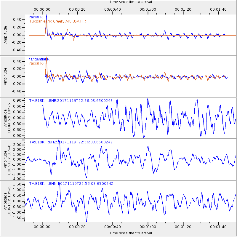
E18K Tukpahlearik Creek, AK, USA - Earthquake Result Viewer
*The percent match for this event was below the threshold and hence no stack was calculated.
| Earthquake location: |
Loyalty Islands |
| Earthquake latitude/longitude: |
-21.3/168.5 |
| Earthquake time(UTC): |
2017/11/19 (323) 22:43:29 GMT |
| Earthquake Depth: |
25 km |
| Earthquake Magnitude: |
7.3 Mi |
| Earthquake Catalog/Contributor: |
NEIC PDE/at |
|
| Network: |
TA USArray Transportable Network (new EarthScope stations) |
| Station: |
E18K Tukpahlearik Creek, AK, USA |
| Lat/Lon: |
67.42 N/160.60 W |
| Elevation: |
297 m |
|
| Distance: |
91.4 deg |
| Az: |
11.44 deg |
| Baz: |
208.619 deg |
| Ray Param: |
$rayparam |
*The percent match for this event was below the threshold and hence was not used in the summary stack. |
|
| Radial Match: |
83.81502 % |
| Radial Bump: |
400 |
| Transverse Match: |
75.77404 % |
| Transverse Bump: |
400 |
| SOD ConfigId: |
13570011 |
| Insert Time: |
2019-04-29 07:09:11.519 +0000 |
| GWidth: |
2.5 |
| Max Bumps: |
400 |
| Tol: |
0.001 |
|
Signal To Noise
| Channel | StoN | STA | LTA |
| TA:E18K: :BHZ:20171119T22:56:03.650024Z | 2.349158 | 7.575263E-7 | 3.2246714E-7 |
| TA:E18K: :BHN:20171119T22:56:03.650024Z | 1.5347514 | 4.4592826E-7 | 2.9055406E-7 |
| TA:E18K: :BHE:20171119T22:56:03.650024Z | 1.0937237 | 2.697878E-7 | 2.4666906E-7 |
| Arrivals |
| Ps | |
| PpPs | |
| PsPs/PpSs | |


