You are here: Home > Network List > TA - USArray Transportable Network (new EarthScope stations) Stations List
> Station K13K Kusilvak Mountain, AK, USA > Earthquake Result Viewer
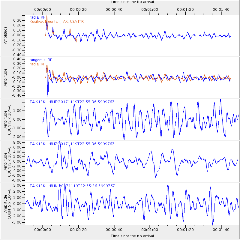
K13K Kusilvak Mountain, AK, USA - Earthquake Result Viewer
*The percent match for this event was below the threshold and hence no stack was calculated.
| Earthquake location: |
Loyalty Islands |
| Earthquake latitude/longitude: |
-21.3/168.5 |
| Earthquake time(UTC): |
2017/11/19 (323) 22:43:29 GMT |
| Earthquake Depth: |
25 km |
| Earthquake Magnitude: |
7.3 Mi |
| Earthquake Catalog/Contributor: |
NEIC PDE/at |
|
| Network: |
TA USArray Transportable Network (new EarthScope stations) |
| Station: |
K13K Kusilvak Mountain, AK, USA |
| Lat/Lon: |
61.93 N/164.66 W |
| Elevation: |
204 m |
|
| Distance: |
85.7 deg |
| Az: |
12.368 deg |
| Baz: |
204.98 deg |
| Ray Param: |
$rayparam |
*The percent match for this event was below the threshold and hence was not used in the summary stack. |
|
| Radial Match: |
71.92764 % |
| Radial Bump: |
400 |
| Transverse Match: |
51.474174 % |
| Transverse Bump: |
400 |
| SOD ConfigId: |
13570011 |
| Insert Time: |
2019-04-29 07:10:03.072 +0000 |
| GWidth: |
2.5 |
| Max Bumps: |
400 |
| Tol: |
0.001 |
|
Signal To Noise
| Channel | StoN | STA | LTA |
| TA:K13K: :BHZ:20171119T22:55:36.599976Z | 1.8345101 | 1.5689468E-6 | 8.552402E-7 |
| TA:K13K: :BHN:20171119T22:55:36.599976Z | 1.099848 | 7.7823785E-7 | 7.0758676E-7 |
| TA:K13K: :BHE:20171119T22:55:36.599976Z | 0.84746796 | 7.618875E-7 | 8.990163E-7 |
| Arrivals |
| Ps | |
| PpPs | |
| PsPs/PpSs | |


