You are here: Home > Network List > UW - Pacific Northwest Regional Seismic Network Stations List
> Station HOOD Mt Hood Meadows, OR CREST BB SMO > Earthquake Result Viewer
HOOD Mt Hood Meadows, OR CREST BB SMO - Earthquake Result Viewer
*The percent match for this event was below the threshold and hence no stack was calculated.
| Earthquake location: |
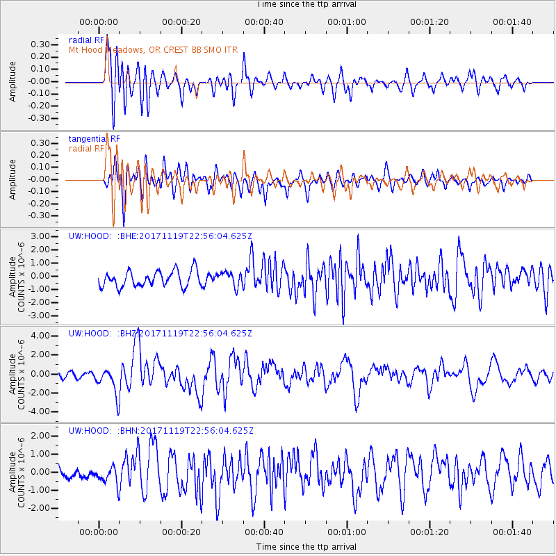
Loyalty Islands |
| Earthquake latitude/longitude: |
-21.3/168.5 |
| Earthquake time(UTC): |
2017/11/19 (323) 22:43:29 GMT |
| Earthquake Depth: |
25 km |
| Earthquake Magnitude: |
7.3 Mi |
| Earthquake Catalog/Contributor: |
NEIC PDE/at |
|
| Network: |
UW Pacific Northwest Regional Seismic Network |
| Station: |
HOOD Mt Hood Meadows, OR CREST BB SMO |
| Lat/Lon: |
45.32 N/121.65 W |
| Elevation: |
1520 m |
|
| Distance: |
91.7 deg |
| Az: |
41.499 deg |
| Baz: |
241.139 deg |
| Ray Param: |
$rayparam |
*The percent match for this event was below the threshold and hence was not used in the summary stack. |
|
| Radial Match: |
69.74662 % |
| Radial Bump: |
400 |
| Transverse Match: |
74.19434 % |
| Transverse Bump: |
400 |
| SOD ConfigId: |
13570011 |
| Insert Time: |
2019-04-29 07:11:50.199 +0000 |
| GWidth: |
2.5 |
| Max Bumps: |
400 |
| Tol: |
0.001 |
|
Signal To Noise
| Channel | StoN | STA | LTA |
| UW:HOOD: :BHZ:20171119T22:56:04.625Z | 4.5616236 | 1.5036917E-6 | 3.2963956E-7 |
| UW:HOOD: :BHN:20171119T22:56:04.625Z | 1.4413992 | 4.8656534E-7 | 3.375646E-7 |
| UW:HOOD: :BHE:20171119T22:56:04.625Z | 0.76623166 | 4.2339516E-7 | 5.525681E-7 |
| Arrivals |
| Ps | |
| PpPs | |
| PsPs/PpSs | |


