You are here: Home > Network List > TA - USArray Transportable Network (new EarthScope stations) Stations List
> Station R32K Eaglecrest, AK, USA > Earthquake Result Viewer
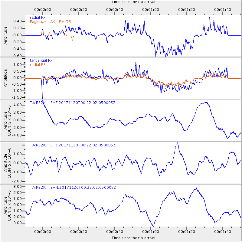
R32K Eaglecrest, AK, USA - Earthquake Result Viewer
*The percent match for this event was below the threshold and hence no stack was calculated.
| Earthquake location: |
Loyalty Islands |
| Earthquake latitude/longitude: |
-21.5/168.8 |
| Earthquake time(UTC): |
2017/11/20 (324) 00:09:23 GMT |
| Earthquake Depth: |
10 km |
| Earthquake Magnitude: |
6.0 Mww |
| Earthquake Catalog/Contributor: |
NEIC PDE/us |
|
| Network: |
TA USArray Transportable Network (new EarthScope stations) |
| Station: |
R32K Eaglecrest, AK, USA |
| Lat/Lon: |
58.27 N/134.52 W |
| Elevation: |
386 m |
|
| Distance: |
92.2 deg |
| Az: |
26.217 deg |
| Baz: |
231.125 deg |
| Ray Param: |
$rayparam |
*The percent match for this event was below the threshold and hence was not used in the summary stack. |
|
| Radial Match: |
52.588036 % |
| Radial Bump: |
400 |
| Transverse Match: |
61.557896 % |
| Transverse Bump: |
400 |
| SOD ConfigId: |
13570011 |
| Insert Time: |
2019-04-29 07:17:02.019 +0000 |
| GWidth: |
2.5 |
| Max Bumps: |
400 |
| Tol: |
0.001 |
|
Signal To Noise
| Channel | StoN | STA | LTA |
| TA:R32K: :BHZ:20171120T00:22:02.050005Z | 1.1536384 | 5.136956E-7 | 4.4528306E-7 |
| TA:R32K: :BHN:20171120T00:22:02.050005Z | 0.8483873 | 1.0120306E-6 | 1.1928875E-6 |
| TA:R32K: :BHE:20171120T00:22:02.050005Z | 1.4964689 | 2.0769833E-6 | 1.3879228E-6 |
| Arrivals |
| Ps | |
| PpPs | |
| PsPs/PpSs | |


