You are here: Home > Network List > CI - Caltech Regional Seismic Network Stations List
> Station MPM Manuel Prospect Mine, California, USA > Earthquake Result Viewer
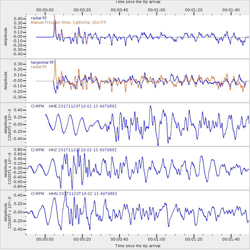
MPM Manuel Prospect Mine, California, USA - Earthquake Result Viewer
*The percent match for this event was below the threshold and hence no stack was calculated.
| Earthquake location: |
Samoa Islands Region |
| Earthquake latitude/longitude: |
-14.4/-175.1 |
| Earthquake time(UTC): |
2017/11/20 (324) 18:51:04 GMT |
| Earthquake Depth: |
10 km |
| Earthquake Magnitude: |
6.2 Mi |
| Earthquake Catalog/Contributor: |
NEIC PDE/pt |
|
| Network: |
CI Caltech Regional Seismic Network |
| Station: |
MPM Manuel Prospect Mine, California, USA |
| Lat/Lon: |
36.06 N/117.49 W |
| Elevation: |
185 m |
|
| Distance: |
74.0 deg |
| Az: |
45.409 deg |
| Baz: |
238.402 deg |
| Ray Param: |
$rayparam |
*The percent match for this event was below the threshold and hence was not used in the summary stack. |
|
| Radial Match: |
56.37257 % |
| Radial Bump: |
400 |
| Transverse Match: |
50.60569 % |
| Transverse Bump: |
400 |
| SOD ConfigId: |
13570011 |
| Insert Time: |
2019-04-29 07:20:21.242 +0000 |
| GWidth: |
2.5 |
| Max Bumps: |
400 |
| Tol: |
0.001 |
|
Signal To Noise
| Channel | StoN | STA | LTA |
| CI:MPM: :HHZ:20171120T19:02:13.497986Z | 2.689946 | 2.6346927E-7 | 9.7945936E-8 |
| CI:MPM: :HHN:20171120T19:02:13.497986Z | 1.0942235 | 1.9261765E-7 | 1.7603135E-7 |
| CI:MPM: :HHE:20171120T19:02:13.497986Z | 0.32480294 | 5.680962E-8 | 1.7490488E-7 |
| Arrivals |
| Ps | |
| PpPs | |
| PsPs/PpSs | |


