You are here: Home > Network List > CN - Canadian National Seismograph Network Stations List
> Station INK INUVIK, NT > Earthquake Result Viewer
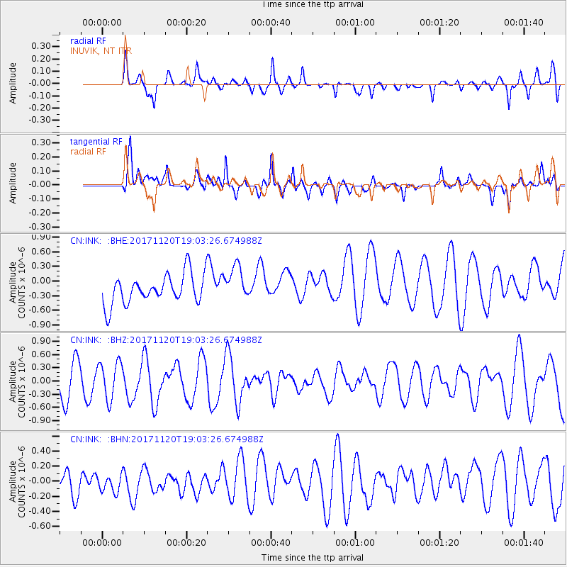
INK INUVIK, NT - Earthquake Result Viewer
*The percent match for this event was below the threshold and hence no stack was calculated.
| Earthquake location: |
Samoa Islands Region |
| Earthquake latitude/longitude: |
-14.4/-175.1 |
| Earthquake time(UTC): |
2017/11/20 (324) 18:51:04 GMT |
| Earthquake Depth: |
10 km |
| Earthquake Magnitude: |
6.2 Mi |
| Earthquake Catalog/Contributor: |
NEIC PDE/pt |
|
| Network: |
CN Canadian National Seismograph Network |
| Station: |
INK INUVIK, NT |
| Lat/Lon: |
68.31 N/133.53 W |
| Elevation: |
44 m |
|
| Distance: |
87.7 deg |
| Az: |
14.306 deg |
| Baz: |
220.099 deg |
| Ray Param: |
$rayparam |
*The percent match for this event was below the threshold and hence was not used in the summary stack. |
|
| Radial Match: |
42.58009 % |
| Radial Bump: |
400 |
| Transverse Match: |
35.994537 % |
| Transverse Bump: |
400 |
| SOD ConfigId: |
13570011 |
| Insert Time: |
2019-04-29 07:20:44.404 +0000 |
| GWidth: |
2.5 |
| Max Bumps: |
400 |
| Tol: |
0.001 |
|
Signal To Noise
| Channel | StoN | STA | LTA |
| CN:INK: :BHZ:20171120T19:03:26.674988Z | 1.2321298 | 4.2792794E-7 | 3.473075E-7 |
| CN:INK: :BHN:20171120T19:03:26.674988Z | 0.90209216 | 1.3201104E-7 | 1.4633875E-7 |
| CN:INK: :BHE:20171120T19:03:26.674988Z | 1.9171546 | 4.6075286E-7 | 2.4033162E-7 |
| Arrivals |
| Ps | |
| PpPs | |
| PsPs/PpSs | |


