You are here: Home > Network List > TA - USArray Transportable Network (new EarthScope stations) Stations List
> Station BGNE Belgrade, NE, USA > Earthquake Result Viewer
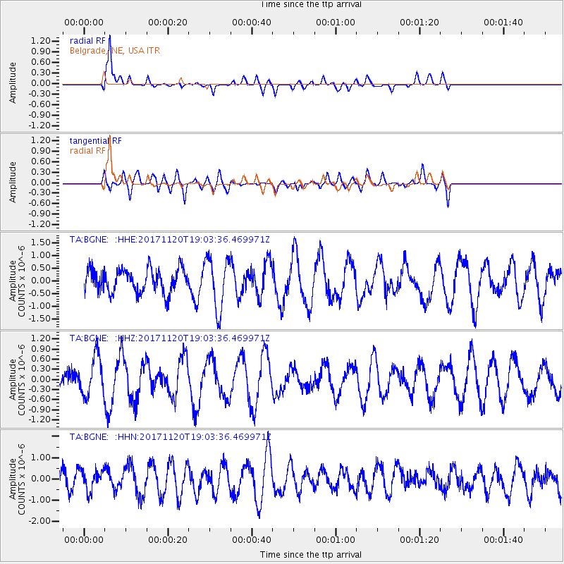
BGNE Belgrade, NE, USA - Earthquake Result Viewer
*The percent match for this event was below the threshold and hence no stack was calculated.
| Earthquake location: |
Samoa Islands Region |
| Earthquake latitude/longitude: |
-14.4/-175.1 |
| Earthquake time(UTC): |
2017/11/20 (324) 18:51:04 GMT |
| Earthquake Depth: |
10 km |
| Earthquake Magnitude: |
6.2 Mi |
| Earthquake Catalog/Contributor: |
NEIC PDE/pt |
|
| Network: |
TA USArray Transportable Network (new EarthScope stations) |
| Station: |
BGNE Belgrade, NE, USA |
| Lat/Lon: |
41.41 N/98.15 W |
| Elevation: |
573 m |
|
| Distance: |
89.9 deg |
| Az: |
47.13 deg |
| Baz: |
250.78 deg |
| Ray Param: |
$rayparam |
*The percent match for this event was below the threshold and hence was not used in the summary stack. |
|
| Radial Match: |
87.39301 % |
| Radial Bump: |
400 |
| Transverse Match: |
59.936974 % |
| Transverse Bump: |
400 |
| SOD ConfigId: |
13570011 |
| Insert Time: |
2019-04-29 07:23:22.070 +0000 |
| GWidth: |
2.5 |
| Max Bumps: |
400 |
| Tol: |
0.001 |
|
Signal To Noise
| Channel | StoN | STA | LTA |
| TA:BGNE: :HHZ:20171120T19:03:36.469971Z | 2.0603664 | 6.082741E-7 | 2.952262E-7 |
| TA:BGNE: :HHN:20171120T19:03:36.469971Z | 0.9275793 | 4.8805373E-7 | 5.2615854E-7 |
| TA:BGNE: :HHE:20171120T19:03:36.469971Z | 1.532202 | 6.9083023E-7 | 4.5087415E-7 |
| Arrivals |
| Ps | |
| PpPs | |
| PsPs/PpSs | |


