You are here: Home > Network List > TA - USArray Transportable Network (new EarthScope stations) Stations List
> Station R32K Eaglecrest, AK, USA > Earthquake Result Viewer
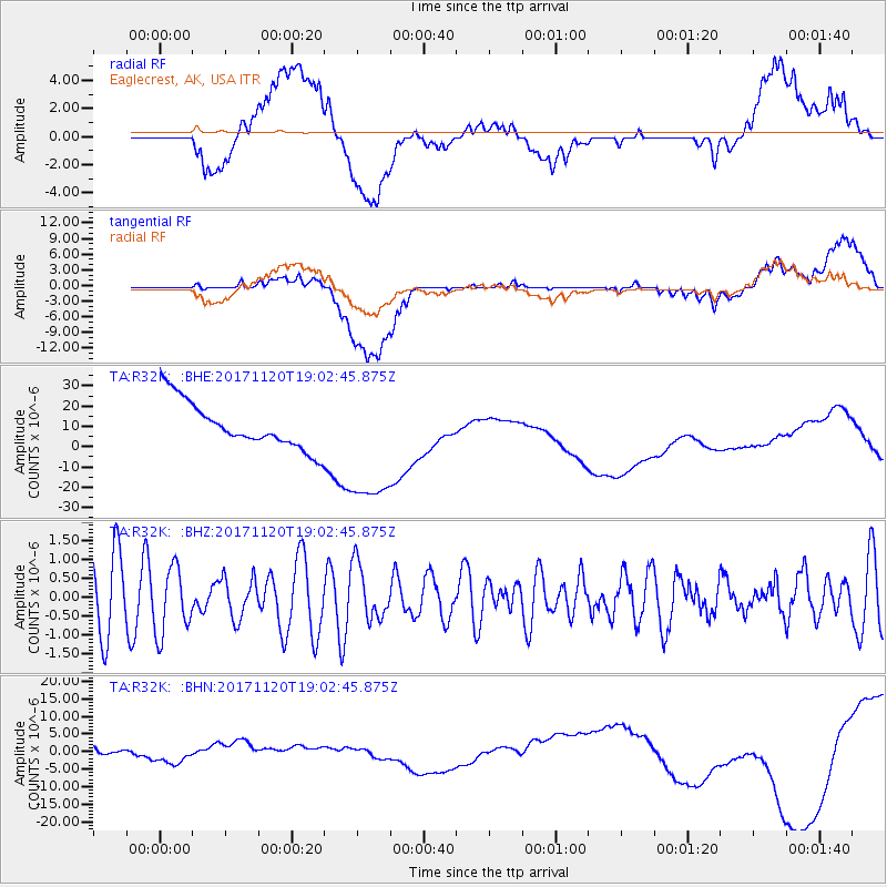
R32K Eaglecrest, AK, USA - Earthquake Result Viewer
*The percent match for this event was below the threshold and hence no stack was calculated.
| Earthquake location: |
Samoa Islands Region |
| Earthquake latitude/longitude: |
-14.4/-175.1 |
| Earthquake time(UTC): |
2017/11/20 (324) 18:51:04 GMT |
| Earthquake Depth: |
10 km |
| Earthquake Magnitude: |
6.2 Mi |
| Earthquake Catalog/Contributor: |
NEIC PDE/pt |
|
| Network: |
TA USArray Transportable Network (new EarthScope stations) |
| Station: |
R32K Eaglecrest, AK, USA |
| Lat/Lon: |
58.27 N/134.52 W |
| Elevation: |
386 m |
|
| Distance: |
79.7 deg |
| Az: |
20.467 deg |
| Baz: |
219.892 deg |
| Ray Param: |
$rayparam |
*The percent match for this event was below the threshold and hence was not used in the summary stack. |
|
| Radial Match: |
17.323738 % |
| Radial Bump: |
400 |
| Transverse Match: |
37.086483 % |
| Transverse Bump: |
400 |
| SOD ConfigId: |
13570011 |
| Insert Time: |
2019-04-29 07:23:53.444 +0000 |
| GWidth: |
2.5 |
| Max Bumps: |
400 |
| Tol: |
0.001 |
|
Signal To Noise
| Channel | StoN | STA | LTA |
| TA:R32K: :BHZ:20171120T19:02:45.875Z | 0.809605 | 8.970211E-7 | 1.1079737E-6 |
| TA:R32K: :BHN:20171120T19:02:45.875Z | 2.8569012 | 3.3317303E-6 | 1.1662042E-6 |
| TA:R32K: :BHE:20171120T19:02:45.875Z | 2.820366 | 2.8914385E-5 | 1.0251997E-5 |
| Arrivals |
| Ps | |
| PpPs | |
| PsPs/PpSs | |


