You are here: Home > Network List > IU - Global Seismograph Network (GSN - IRIS/USGS) Stations List
> Station FURI Mt. Furi, Ethiopia > Earthquake Result Viewer
FURI Mt. Furi, Ethiopia - Earthquake Result Viewer
*The percent match for this event was below the threshold and hence no stack was calculated.
| Earthquake location: |
Southern Sumatra, Indonesia |
| Earthquake latitude/longitude: |
-4.1/102.3 |
| Earthquake time(UTC): |
2016/04/10 (101) 02:14:36 GMT |
| Earthquake Depth: |
55 km |
| Earthquake Magnitude: |
5.7 MWP |
| Earthquake Catalog/Contributor: |
NEIC PDE/NEIC COMCAT |
|
| Network: |
IU Global Seismograph Network (GSN - IRIS/USGS) |
| Station: |
FURI Mt. Furi, Ethiopia |
| Lat/Lon: |
8.90 N/38.68 E |
| Elevation: |
2570 m |
|
| Distance: |
64.7 deg |
| Az: |
281.793 deg |
| Baz: |
98.849 deg |
| Ray Param: |
$rayparam |
*The percent match for this event was below the threshold and hence was not used in the summary stack. |
|
| Radial Match: |
73.86116 % |
| Radial Bump: |
400 |
| Transverse Match: |
69.8556 % |
| Transverse Bump: |
400 |
| SOD ConfigId: |
1475611 |
| Insert Time: |
2016-04-24 02:18:40.907 +0000 |
| GWidth: |
2.5 |
| Max Bumps: |
400 |
| Tol: |
0.001 |
|
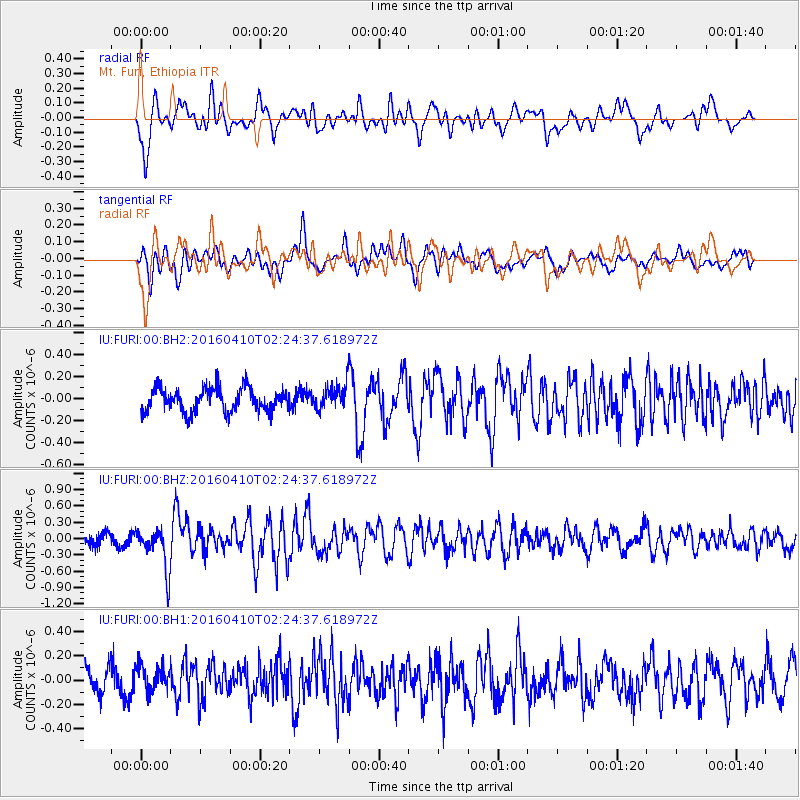
Signal To Noise
| Channel | StoN | STA | LTA |
| IU:FURI:00:BHZ:20160410T02:24:37.618972Z | 4.338422 | 3.8766092E-7 | 8.935528E-8 |
| IU:FURI:00:BH1:20160410T02:24:37.618972Z | 1.2150018 | 1.10974746E-7 | 9.133711E-8 |
| IU:FURI:00:BH2:20160410T02:24:37.618972Z | 1.0397049 | 1.1267645E-7 | 1.0837349E-7 |
| Arrivals |
| Ps | |
| PpPs | |
| PsPs/PpSs | |


