You are here: Home > Network List > TJ - Tajikistan National Seismic Network Stations List
> Station GARM Garm, Tajikistan > Earthquake Result Viewer
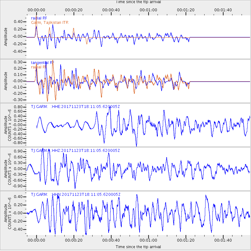
GARM Garm, Tajikistan - Earthquake Result Viewer
*The percent match for this event was below the threshold and hence no stack was calculated.
| Earthquake location: |
Ryukyu Islands, Japan |
| Earthquake latitude/longitude: |
27.1/130.4 |
| Earthquake time(UTC): |
2017/11/23 (327) 18:02:35 GMT |
| Earthquake Depth: |
10 km |
| Earthquake Magnitude: |
5.5 Mww |
| Earthquake Catalog/Contributor: |
NEIC PDE/us |
|
| Network: |
TJ Tajikistan National Seismic Network |
| Station: |
GARM Garm, Tajikistan |
| Lat/Lon: |
39.00 N/70.32 E |
| Elevation: |
1305 m |
|
| Distance: |
50.9 deg |
| Az: |
299.5 deg |
| Baz: |
84.462 deg |
| Ray Param: |
$rayparam |
*The percent match for this event was below the threshold and hence was not used in the summary stack. |
|
| Radial Match: |
59.61967 % |
| Radial Bump: |
400 |
| Transverse Match: |
70.493 % |
| Transverse Bump: |
400 |
| SOD ConfigId: |
13570011 |
| Insert Time: |
2019-04-29 07:31:24.058 +0000 |
| GWidth: |
2.5 |
| Max Bumps: |
400 |
| Tol: |
0.001 |
|
Signal To Noise
| Channel | StoN | STA | LTA |
| TJ:GARM: :HHZ:20171123T18:11:05.620005Z | 4.4628954 | 5.2652075E-7 | 1.17977386E-7 |
| TJ:GARM: :HHN:20171123T18:11:05.620005Z | 0.85385203 | 1.5420197E-7 | 1.8059566E-7 |
| TJ:GARM: :HHE:20171123T18:11:05.620005Z | 1.9886221 | 2.7586353E-7 | 1.3872094E-7 |
| Arrivals |
| Ps | |
| PpPs | |
| PsPs/PpSs | |


