You are here: Home > Network List > TA - USArray Transportable Network (new EarthScope stations) Stations List
> Station A12A Yaak River Ranch, Troy, MT, USA > Earthquake Result Viewer
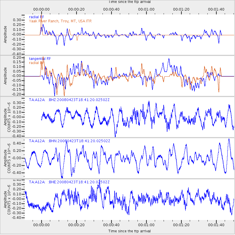
A12A Yaak River Ranch, Troy, MT, USA - Earthquake Result Viewer
*The percent match for this event was below the threshold and hence no stack was calculated.
| Earthquake location: |
Taiwan Region |
| Earthquake latitude/longitude: |
22.9/121.6 |
| Earthquake time(UTC): |
2008/04/23 (114) 18:28:41 GMT |
| Earthquake Depth: |
10 km |
| Earthquake Magnitude: |
5.6 MB, 5.9 MS, 6.0 MW, 6.0 MW |
| Earthquake Catalog/Contributor: |
WHDF/NEIC |
|
| Network: |
TA USArray Transportable Network (new EarthScope stations) |
| Station: |
A12A Yaak River Ranch, Troy, MT, USA |
| Lat/Lon: |
48.93 N/115.65 W |
| Elevation: |
928 m |
|
| Distance: |
92.2 deg |
| Az: |
33.721 deg |
| Baz: |
309.068 deg |
| Ray Param: |
$rayparam |
*The percent match for this event was below the threshold and hence was not used in the summary stack. |
|
| Radial Match: |
52.56443 % |
| Radial Bump: |
400 |
| Transverse Match: |
38.986588 % |
| Transverse Bump: |
400 |
| SOD ConfigId: |
2504 |
| Insert Time: |
2010-03-06 06:57:47.065 +0000 |
| GWidth: |
2.5 |
| Max Bumps: |
400 |
| Tol: |
0.001 |
|
Signal To Noise
| Channel | StoN | STA | LTA |
| TA:A12A: :BHN:20080423T18:41:20.02502Z | 1.1008812 | 1.594396E-7 | 1.4482906E-7 |
| TA:A12A: :BHE:20080423T18:41:20.02502Z | 2.2731888 | 2.4774062E-7 | 1.08983734E-7 |
| TA:A12A: :BHZ:20080423T18:41:20.02502Z | 1.5137082 | 1.3621316E-7 | 8.99864E-8 |
| Arrivals |
| Ps | |
| PpPs | |
| PsPs/PpSs | |


