You are here: Home > Network List > UW - Pacific Northwest Regional Seismic Network Stations List
> Station MRBL Marblemount, WA, USA > Earthquake Result Viewer
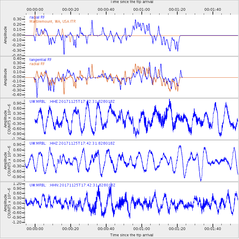
MRBL Marblemount, WA, USA - Earthquake Result Viewer
*The percent match for this event was below the threshold and hence no stack was calculated.
| Earthquake location: |
Vanuatu Islands Region |
| Earthquake latitude/longitude: |
-20.6/172.6 |
| Earthquake time(UTC): |
2017/11/25 (329) 17:30:01 GMT |
| Earthquake Depth: |
10 km |
| Earthquake Magnitude: |
5.8 Mww |
| Earthquake Catalog/Contributor: |
NEIC PDE/us |
|
| Network: |
UW Pacific Northwest Regional Seismic Network |
| Station: |
MRBL Marblemount, WA, USA |
| Lat/Lon: |
48.52 N/121.48 W |
| Elevation: |
75 m |
|
| Distance: |
90.4 deg |
| Az: |
37.386 deg |
| Baz: |
238.807 deg |
| Ray Param: |
$rayparam |
*The percent match for this event was below the threshold and hence was not used in the summary stack. |
|
| Radial Match: |
66.05308 % |
| Radial Bump: |
400 |
| Transverse Match: |
62.91473 % |
| Transverse Bump: |
400 |
| SOD ConfigId: |
13570011 |
| Insert Time: |
2019-04-29 07:37:09.233 +0000 |
| GWidth: |
2.5 |
| Max Bumps: |
400 |
| Tol: |
0.001 |
|
Signal To Noise
| Channel | StoN | STA | LTA |
| UW:MRBL: :HHZ:20171125T17:42:31.828018Z | 0.7384857 | 3.6317923E-7 | 4.917891E-7 |
| UW:MRBL: :HHN:20171125T17:42:31.828018Z | 1.1914734 | 3.3749728E-7 | 2.8326045E-7 |
| UW:MRBL: :HHE:20171125T17:42:31.828018Z | 1.5375677 | 6.674365E-7 | 4.3408588E-7 |
| Arrivals |
| Ps | |
| PpPs | |
| PsPs/PpSs | |


