You are here: Home > Network List > TA - USArray Transportable Network (new EarthScope stations) Stations List
> Station A12A Yaak River Ranch, Troy, MT, USA > Earthquake Result Viewer
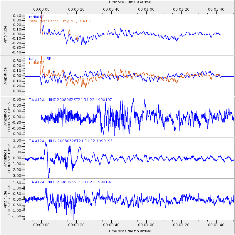
A12A Yaak River Ranch, Troy, MT, USA - Earthquake Result Viewer
*The percent match for this event was below the threshold and hence no stack was calculated.
| Earthquake location: |
Tonga Islands |
| Earthquake latitude/longitude: |
-20.8/-173.3 |
| Earthquake time(UTC): |
2008/06/26 (178) 21:19:15 GMT |
| Earthquake Depth: |
38 km |
| Earthquake Magnitude: |
6.0 MB, 5.8 MS, 6.2 MW, 6.1 MW |
| Earthquake Catalog/Contributor: |
WHDF/NEIC |
|
| Network: |
TA USArray Transportable Network (new EarthScope stations) |
| Station: |
A12A Yaak River Ranch, Troy, MT, USA |
| Lat/Lon: |
48.93 N/115.65 W |
| Elevation: |
928 m |
|
| Distance: |
86.3 deg |
| Az: |
33.953 deg |
| Baz: |
232.427 deg |
| Ray Param: |
$rayparam |
*The percent match for this event was below the threshold and hence was not used in the summary stack. |
|
| Radial Match: |
77.91756 % |
| Radial Bump: |
400 |
| Transverse Match: |
73.58332 % |
| Transverse Bump: |
400 |
| SOD ConfigId: |
2504 |
| Insert Time: |
2010-03-06 06:58:21.219 +0000 |
| GWidth: |
2.5 |
| Max Bumps: |
400 |
| Tol: |
0.001 |
|
Signal To Noise
| Channel | StoN | STA | LTA |
| TA:A12A: :BHN:20080626T21:31:22.199019Z | 12.474382 | 1.6363899E-6 | 1.3118003E-7 |
| TA:A12A: :BHE:20080626T21:31:22.199019Z | 2.6553724 | 4.9884517E-7 | 1.878626E-7 |
| TA:A12A: :BHZ:20080626T21:31:22.199019Z | 2.058429 | 3.8940723E-7 | 1.891769E-7 |
| Arrivals |
| Ps | |
| PpPs | |
| PsPs/PpSs | |


