You are here: Home > Network List > TA - USArray Transportable Network (new EarthScope stations) Stations List
> Station D25K Kavik River, AK, USA > Earthquake Result Viewer
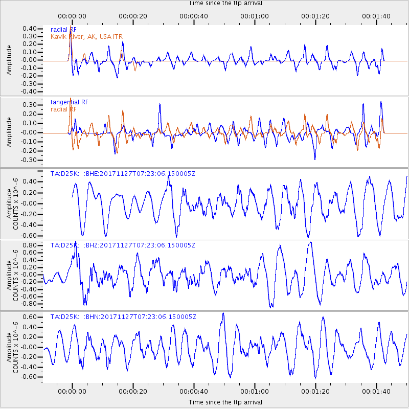
D25K Kavik River, AK, USA - Earthquake Result Viewer
*The percent match for this event was below the threshold and hence no stack was calculated.
| Earthquake location: |
New Ireland Region, P.N.G. |
| Earthquake latitude/longitude: |
-4.6/153.2 |
| Earthquake time(UTC): |
2017/11/27 (331) 07:11:12 GMT |
| Earthquake Depth: |
58 km |
| Earthquake Magnitude: |
6.0 Mww |
| Earthquake Catalog/Contributor: |
NEIC PDE/us |
|
| Network: |
TA USArray Transportable Network (new EarthScope stations) |
| Station: |
D25K Kavik River, AK, USA |
| Lat/Lon: |
69.32 N/146.38 W |
| Elevation: |
770 m |
|
| Distance: |
84.3 deg |
| Az: |
18.086 deg |
| Baz: |
240.599 deg |
| Ray Param: |
$rayparam |
*The percent match for this event was below the threshold and hence was not used in the summary stack. |
|
| Radial Match: |
60.701885 % |
| Radial Bump: |
400 |
| Transverse Match: |
60.685154 % |
| Transverse Bump: |
347 |
| SOD ConfigId: |
13570011 |
| Insert Time: |
2019-04-29 07:41:54.183 +0000 |
| GWidth: |
2.5 |
| Max Bumps: |
400 |
| Tol: |
0.001 |
|
Signal To Noise
| Channel | StoN | STA | LTA |
| TA:D25K: :BHZ:20171127T07:23:06.150005Z | 1.8610259 | 5.284161E-7 | 2.8393805E-7 |
| TA:D25K: :BHN:20171127T07:23:06.150005Z | 0.9340811 | 2.7284412E-7 | 2.9209897E-7 |
| TA:D25K: :BHE:20171127T07:23:06.150005Z | 1.3512877 | 3.4232798E-7 | 2.5333463E-7 |
| Arrivals |
| Ps | |
| PpPs | |
| PsPs/PpSs | |


