You are here: Home > Network List > TA - USArray Transportable Network (new EarthScope stations) Stations List
> Station A12A Yaak River Ranch, Troy, MT, USA > Earthquake Result Viewer
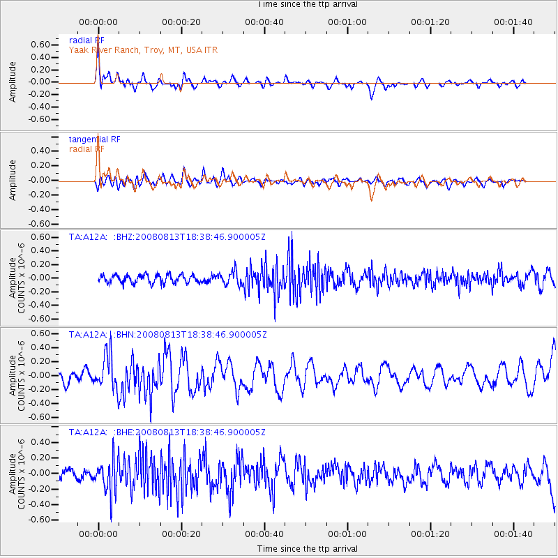
A12A Yaak River Ranch, Troy, MT, USA - Earthquake Result Viewer
*The percent match for this event was below the threshold and hence no stack was calculated.
| Earthquake location: |
North Of Severnaya Zemlya |
| Earthquake latitude/longitude: |
83.6/114.5 |
| Earthquake time(UTC): |
2008/08/13 (226) 18:30:57 GMT |
| Earthquake Depth: |
10 km |
| Earthquake Magnitude: |
5.7 MW, 5.2 MS, 5.3 MB, 5.7 MW |
| Earthquake Catalog/Contributor: |
WHDF/NEIC |
|
| Network: |
TA USArray Transportable Network (new EarthScope stations) |
| Station: |
A12A Yaak River Ranch, Troy, MT, USA |
| Lat/Lon: |
48.93 N/115.65 W |
| Elevation: |
928 m |
|
| Distance: |
45.6 deg |
| Az: |
45.097 deg |
| Baz: |
353.023 deg |
| Ray Param: |
$rayparam |
*The percent match for this event was below the threshold and hence was not used in the summary stack. |
|
| Radial Match: |
65.48109 % |
| Radial Bump: |
400 |
| Transverse Match: |
59.3204 % |
| Transverse Bump: |
400 |
| SOD ConfigId: |
2504 |
| Insert Time: |
2010-03-06 06:58:28.424 +0000 |
| GWidth: |
2.5 |
| Max Bumps: |
400 |
| Tol: |
0.001 |
|
Signal To Noise
| Channel | StoN | STA | LTA |
| TA:A12A: :BHN:20080813T18:38:46.900005Z | 2.5886014 | 2.544826E-7 | 9.8308924E-8 |
| TA:A12A: :BHE:20080813T18:38:46.900005Z | 3.0784106 | 2.2297398E-7 | 7.2431526E-8 |
| TA:A12A: :BHZ:20080813T18:38:46.900005Z | 1.686795 | 9.9254855E-8 | 5.8842275E-8 |
| Arrivals |
| Ps | |
| PpPs | |
| PsPs/PpSs | |


