You are here: Home > Network List > TA - USArray Transportable Network (new EarthScope stations) Stations List
> Station M53A WI Miller and Sons, Farmdale, OH, USA > Earthquake Result Viewer
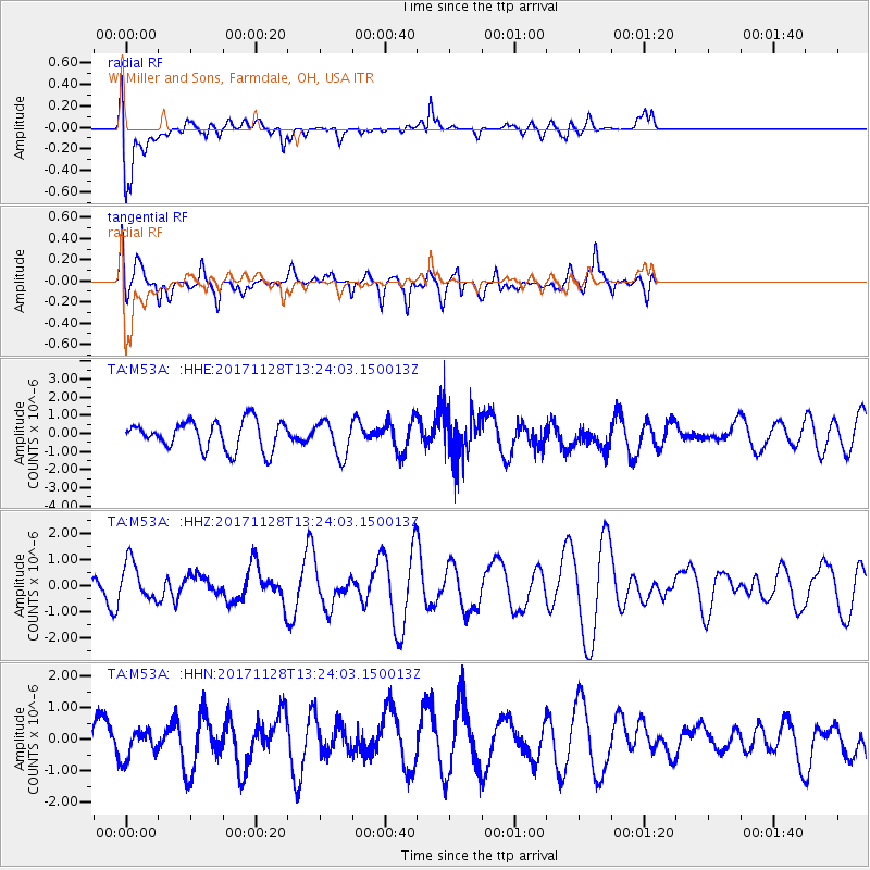
M53A WI Miller and Sons, Farmdale, OH, USA - Earthquake Result Viewer
*The percent match for this event was below the threshold and hence no stack was calculated.
| Earthquake location: |
Norwegian Sea |
| Earthquake latitude/longitude: |
72.6/3.2 |
| Earthquake time(UTC): |
2017/11/28 (332) 13:15:46 GMT |
| Earthquake Depth: |
10 km |
| Earthquake Magnitude: |
5.6 Mww |
| Earthquake Catalog/Contributor: |
NEIC PDE/us |
|
| Network: |
TA USArray Transportable Network (new EarthScope stations) |
| Station: |
M53A WI Miller and Sons, Farmdale, OH, USA |
| Lat/Lon: |
41.44 N/80.68 W |
| Elevation: |
334 m |
|
| Distance: |
49.2 deg |
| Az: |
279.246 deg |
| Baz: |
23.27 deg |
| Ray Param: |
$rayparam |
*The percent match for this event was below the threshold and hence was not used in the summary stack. |
|
| Radial Match: |
85.03835 % |
| Radial Bump: |
400 |
| Transverse Match: |
57.31303 % |
| Transverse Bump: |
400 |
| SOD ConfigId: |
13570011 |
| Insert Time: |
2019-04-29 07:57:18.289 +0000 |
| GWidth: |
2.5 |
| Max Bumps: |
400 |
| Tol: |
0.001 |
|
Signal To Noise
| Channel | StoN | STA | LTA |
| TA:M53A: :HHZ:20171128T13:24:03.150013Z | 0.80257505 | 7.391302E-7 | 9.2094837E-7 |
| TA:M53A: :HHN:20171128T13:24:03.150013Z | 0.570909 | 4.187839E-7 | 7.335388E-7 |
| TA:M53A: :HHE:20171128T13:24:03.150013Z | 1.2742774 | 9.96896E-7 | 7.823226E-7 |
| Arrivals |
| Ps | |
| PpPs | |
| PsPs/PpSs | |


