You are here: Home > Network List > TA - USArray Transportable Network (new EarthScope stations) Stations List
> Station R33M Jennings River, BC, CAN > Earthquake Result Viewer
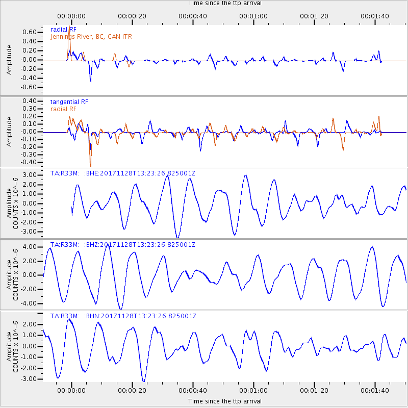
R33M Jennings River, BC, CAN - Earthquake Result Viewer
*The percent match for this event was below the threshold and hence no stack was calculated.
| Earthquake location: |
Norwegian Sea |
| Earthquake latitude/longitude: |
72.6/3.2 |
| Earthquake time(UTC): |
2017/11/28 (332) 13:15:46 GMT |
| Earthquake Depth: |
10 km |
| Earthquake Magnitude: |
5.6 Mww |
| Earthquake Catalog/Contributor: |
NEIC PDE/us |
|
| Network: |
TA USArray Transportable Network (new EarthScope stations) |
| Station: |
R33M Jennings River, BC, CAN |
| Lat/Lon: |
59.39 N/130.97 W |
| Elevation: |
1437 m |
|
| Distance: |
44.6 deg |
| Az: |
328.471 deg |
| Baz: |
17.913 deg |
| Ray Param: |
$rayparam |
*The percent match for this event was below the threshold and hence was not used in the summary stack. |
|
| Radial Match: |
86.23082 % |
| Radial Bump: |
356 |
| Transverse Match: |
63.15845 % |
| Transverse Bump: |
400 |
| SOD ConfigId: |
13570011 |
| Insert Time: |
2019-04-29 07:57:29.383 +0000 |
| GWidth: |
2.5 |
| Max Bumps: |
400 |
| Tol: |
0.001 |
|
Signal To Noise
| Channel | StoN | STA | LTA |
| TA:R33M: :BHZ:20171128T13:23:26.825001Z | 0.9212882 | 1.878358E-6 | 2.0388386E-6 |
| TA:R33M: :BHN:20171128T13:23:26.825001Z | 1.6903462 | 1.8411573E-6 | 1.089219E-6 |
| TA:R33M: :BHE:20171128T13:23:26.825001Z | 2.1852102 | 2.4830936E-6 | 1.136318E-6 |
| Arrivals |
| Ps | |
| PpPs | |
| PsPs/PpSs | |


