You are here: Home > Network List > TA - USArray Transportable Network (new EarthScope stations) Stations List
> Station T25A Trinidad, CO, USA > Earthquake Result Viewer
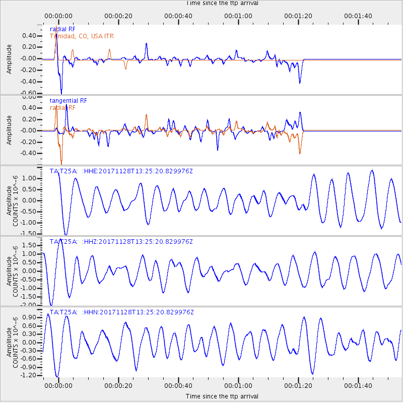
T25A Trinidad, CO, USA - Earthquake Result Viewer
*The percent match for this event was below the threshold and hence no stack was calculated.
| Earthquake location: |
Norwegian Sea |
| Earthquake latitude/longitude: |
72.6/3.2 |
| Earthquake time(UTC): |
2017/11/28 (332) 13:15:46 GMT |
| Earthquake Depth: |
10 km |
| Earthquake Magnitude: |
5.6 Mww |
| Earthquake Catalog/Contributor: |
NEIC PDE/us |
|
| Network: |
TA USArray Transportable Network (new EarthScope stations) |
| Station: |
T25A Trinidad, CO, USA |
| Lat/Lon: |
37.14 N/104.41 W |
| Elevation: |
2017 m |
|
| Distance: |
60.0 deg |
| Az: |
298.364 deg |
| Baz: |
19.353 deg |
| Ray Param: |
$rayparam |
*The percent match for this event was below the threshold and hence was not used in the summary stack. |
|
| Radial Match: |
75.66824 % |
| Radial Bump: |
400 |
| Transverse Match: |
67.744576 % |
| Transverse Bump: |
400 |
| SOD ConfigId: |
13570011 |
| Insert Time: |
2019-04-29 07:57:32.418 +0000 |
| GWidth: |
2.5 |
| Max Bumps: |
400 |
| Tol: |
0.001 |
|
Signal To Noise
| Channel | StoN | STA | LTA |
| TA:T25A: :HHZ:20171128T13:25:20.829976Z | 2.652558 | 1.2433165E-6 | 4.687236E-7 |
| TA:T25A: :HHN:20171128T13:25:20.829976Z | 1.7252921 | 7.894424E-7 | 4.5757028E-7 |
| TA:T25A: :HHE:20171128T13:25:20.829976Z | 1.0100209 | 5.7825594E-7 | 5.725188E-7 |
| Arrivals |
| Ps | |
| PpPs | |
| PsPs/PpSs | |


